Subject: Western Germany, Rhine River
Period: 1541 (published)
Publication: Claudii Ptolemaei Alexandrini Geographicae…
Color: Hand Color
Size:
16.8 x 10.5 inches
42.7 x 26.7 cm
Claudius Ptolemy was a mathematician, astronomer and geographer who worked in Alexandria, then a part of the Roman Empire, in the 2nd century AD. One of the most learned and influential men of his time, his theories dominated both astronomy and geography for nearly 1500 years. His writings were kept alive by Arabic scholars during the Middle Ages and reemerged in Europe during the Renaissance. The birth of printing led to wide dissemination of his great works on astronomy and geography. There were a number of editions of his Geographia beginning in 1477. These early editions contained maps based on his original writings, known as Ptolemaic maps. As geographic knowledge increased with the explorations of Columbus, Magellan, Cabot and others, maps of the New World were added, and maps of the Old World were revised. Ptolemy's Geographia continued to be revised and published by some of the most important cartographers including Martin Waldseemuller, Sebastian Munster, Giacomo Gastaldi, Jodocus Hondius, and Gerard Mercator (whose last edition was published in 1730).
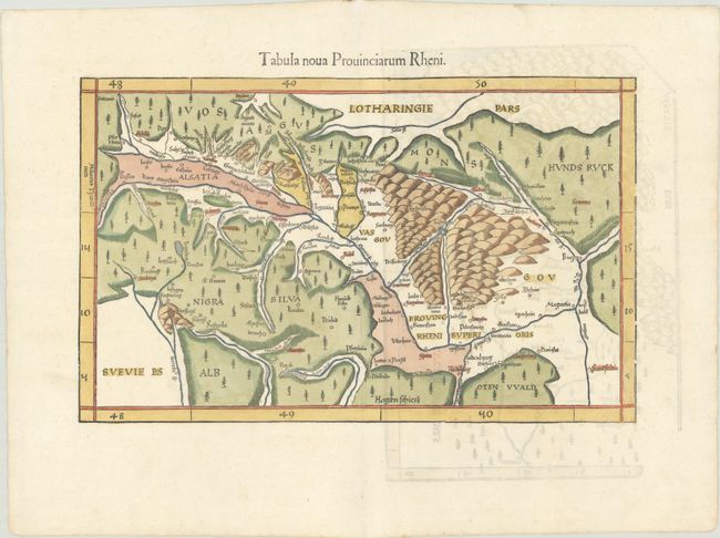
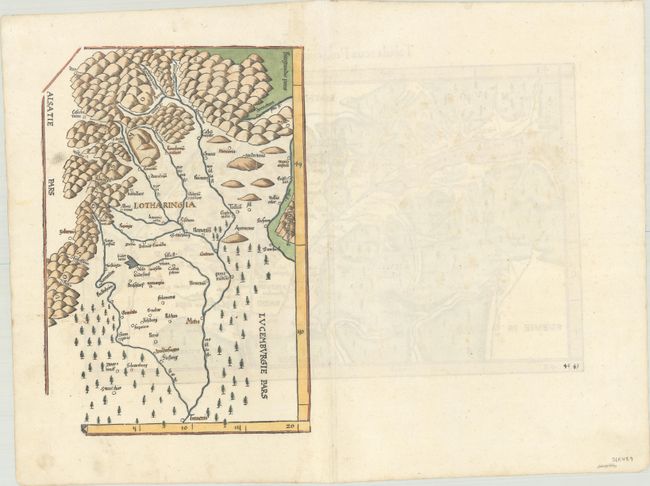
This woodcut is one of the earliest "modern" maps of the Rhine River Valley and the Black Forest region. Oriented with north to the right, the map extends from Frankfurt (Frantfordia) to Basel (Basilea), naming numerous towns in between. On verso is a second map depicting the region directly to the west of the Rhine River Valley depicting the Moselle River between Thionville (Treneris),) Metz (Metis), Nancy (Nancein), and beyond. This edition was printed by Gaspar Treschel and edited by Michael Villanovus (known as Servetus). Servetus was charged with heresy by John Calvin in 1553, in part due to the text in this atlas. The courts found him guilty and sentenced him to burning at the stake, atop a pyre of his own books, including this atlas.
References: Mickwitz & Miekkavaara #211-46.
Condition: A
A clean and bright example on paper with a bunch of grapes watermark, two small worm holes in image, and a professionally repaired centerfold separation in top blank margin.