Subject: Eastern France, Mining
Period: 1552 (published)
Publication: La Cosmographie Universelle...
Color: Black & White
Size:
6.1 x 8.6 inches
15.5 x 21.8 cm
Sebastian Munster (1489 - 1552) was one of the three most renowned cartographers of the sixteenth century, along with Mercator and Ortelius. Munster's Geographia and Cosmographia Universalis were two of the most widely read and influential books of the period. His editions of Ptolemy's Geographia, published between 1540 and 1552, were illustrated with 48 woodcut maps, the standard 27 Ptolemaic maps supplemented by 21 new maps. These new maps included a separate map of each of the known continents and marked the development of regional cartography in Central Europe. The antique geography was a prelude to Munster's major work, the Cosmographia, which was published in nearly 30 editions in six languages between 1544 and 1578 and then was revised and reissued by Sebastian Petri from 1588 to 1628. The Cosmographia was a geographical as well as historical and ethnographic description of the world. It contained the maps from the Geographia plus additional regional maps and city views with nearly 500 illustrations which made it one of the most popular pictorial encyclopedias of the sixteen century.
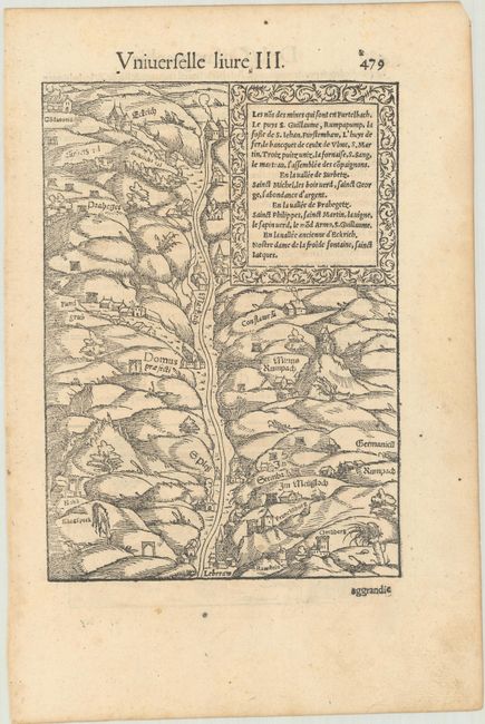
This fascinating and early woodblock view names the mines in Alsace along the La Liepvrette River. Oriented with north to the right, the map shows the city of Liepvre and the Chateau du Haut-Koenigsbourg at bottom, with other small towns such as Minus Rumpach
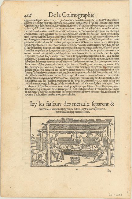
(Petit Rombach) further west. This is one of the first maps to show the location of mines. The view shows simplified topography with villages, castles, and even a gallows noted. French text on verso, along with a small engraving of metalworkers hammering away at their task.
References: Shirley (BL Atlases) T.MUN-1d #52.
Condition: B+
A nice impression with a couple minor dampstains in map image and light soiling and foxing that is mostly confined to the blank margins.