Catalog Archive
Auction 187, Lot 403

"Royaume d'Irlande Divise en ses Quatre Provinces, et Subdivise en Comtes", Robert de Vaugondy/Santini
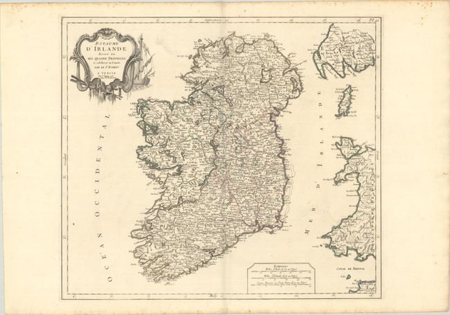
Subject: Ireland

Period: 1778 (dated)

Publication: Atlas Universal

Color: Hand Color

Size:
21.3 x 18.8 inches
54.1 x 47.8 cm
Download High Resolution Image
(or just click on image to launch the Zoom viewer)

An attractive and detailed map of Ireland divided into the counties of Ulster, Leinster, Munster and Connacht. It is densely engraved with numerous towns and villages, castles, rivers, lakes, mountains, and more. The map extends to include the western coast of Wales, Scotland, and the Isle of Man. Features three distance scales at bottom and decorated by a title cartouche featuring a sailboat and oars. Published in Remondini's 1784 edition of Atlas Universel.

References: cf. Pedley #56.

Condition: A

Issued on "R" watermarked paper with minor foxing confined to the top and bottom blank margins.

Estimate: $275 - $350

Sold for: $200

Closed on 4/27/2022

Archived