Subject: Europe
Period: 1690 (circa)
Publication:
Color: Hand Color
Size:
30.4 x 20.8 inches
77.2 x 52.8 cm
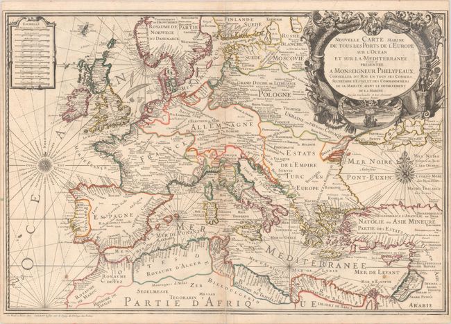
A very decorative and large chart of Europe with rhumb lines and two wind roses filling the waters. There is good detail along the coastlines with some of the larger towns and cities identified in the interior (but otherwise blank). The chart was drawn and engraved by Nicolas Berey and dedicated to Monseigneur Phelypeaaux, counselor to the King and director of the Depot de Marine. Alexis-Hubert Jaillot, Berey's son-in-law, inherited his plates when he passed away in 1665. The beautiful chart contains 11 distance scales and is embellished with a large title cartouche surrounded by military flags and weapons, the royal arms, and a vignette of a sailing ship.
References:
Condition: B+
Issued on a sturdy sheet of watermarked paper with a Maltese Cross encircled in rosary beads. There is light toning along the centerfold, a pair of small stains in the lower corners, and a short centerfold separation at bottom that has been repaired with archival materials on verso.