Subject: World, World War II
Period: 1943 (dated)
Publication:
Color: Printed Color
Size:
40.9 x 33.4 inches
103.9 x 84.8 cm
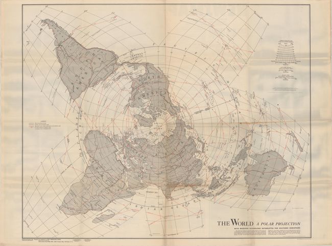
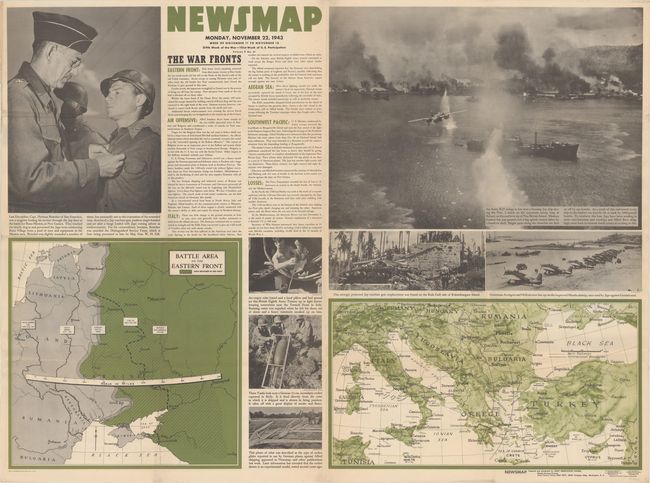
This large-format map shows the world on a north polar projection "with modified extensions interrupted for southern hemisphere." Connecting red lines show air routes with distances noted while both roads and railroads are depicted on land. The map was issued on the verso of the "Newsmap" for Monday, November 22, 1943 which covered the news from November 11-18, 1943 - the 219th week of the war. This issue contains brief text related to the war fronts and two maps showing the European theater of war. Augmenting the maps are several photographic illustrations, including a large image of a B-25 flying over a burning Japanese ship. Prepared by the Army Orientation Course and issued by the U.S. Government Printing Office.
From 1942-46, the U.S. Army published "newsmaps" to keep American troops updated on the war. These weekly posters were distributed and posted in every American installation in the world and were intentionally more visual than descriptive to help engage and motivate personnel.
References:
Condition: B+
Issued folding with a few short fold separations and minor soiling. The bluish hue on the left and right sides of the map are caused by our scanner and not on the physical map.