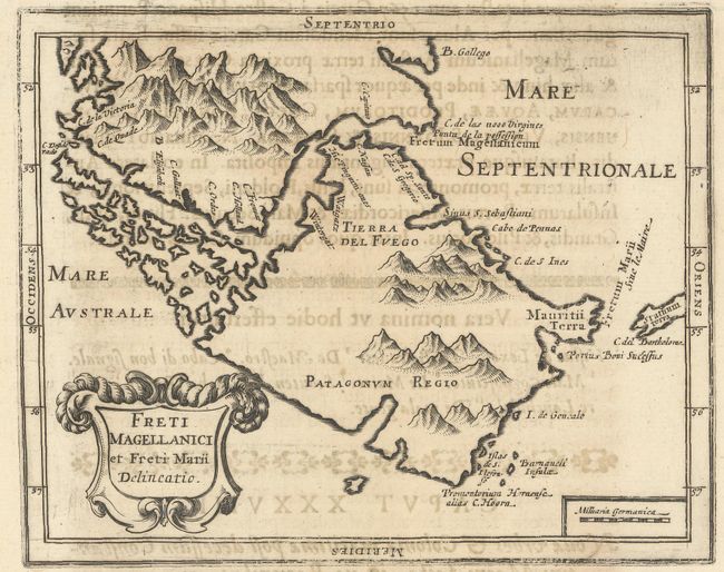
Subject: Tierra del Fuego
Period: 1643 (published)
Publication: Orbis Maritimi
Color: Black & White
Size:
6.5 x 5.2 inches
16.5 x 13.2 cm
This rare map of the Strait of Magellan appeared in the first comprehensive book on naval and maritime history. The map is printed on a sheet (8.3" x 14.0") with Latin text on the lower half and a full page text on the verso. This map shows a large island of Tierra del Fuego to the south of the strait and an un-named land to the north, both covered with mountains. There is a decorative title cartouche in the lower left. We have only found one previous example of this map on the market.
Claude Barthelemy Morisot (1592-1661) was a prominent intellectual of his period, and his works enjoyed great success. Orbis Maritimi is an extensive encyclopedia of everything relating to maritime affairs. The great European expeditions to the coasts of Africa and North America were extensively described. The book contained 44 engraved plates including 23 maps. Later editions did not contain the plates, thus the maps are quite rare.
References:
Condition: B+
The map is a dark, early impression with light toning and show-through of text on verso.