Subject: Central South America, Paraguay
Period: 1643 (circa)
Publication: Theatre du Monde ou Nouvel Atlas
Color: Hand Color
Size:
19 x 14.8 inches
48.3 x 37.6 cm
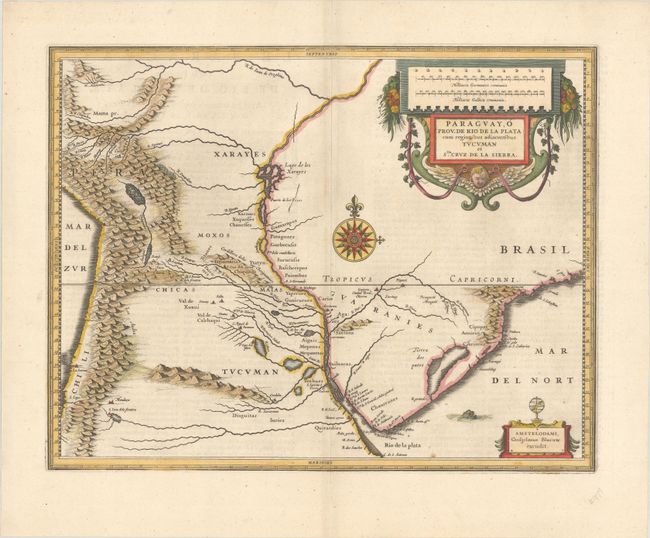
Superb map of the region including the Paraguay River basin and the Peru-Chilean coast with Lake Titicaca. The Rio de la Plata is boldly shown with many large islands in the broad river. The mythical Lago de los Xarayes is featured on the map, which was believed to connect the Rio de la Plata and Amazon River systems. Several towns are named including R. Ianeiro, S. Paulo, Buenos Ayres, Corduba, Medoca, Arica, Potosi and Cusco. A large decorative title cartouche incorporates the distance scales, while a smaller cartouche features an armillary sphere. A fine, large compass rose with fleur-de-lys also adorns the sheet. French text on verso, published between 1643-50.
References: Van der Krogt (Vol. II) #9900:2A.2.
Condition: B+
Nice impression and color on watermarked paper with wide original margins and a small paper flaw in the title cartouche. There are a couple of small worm tracks near the center of the image that have been closed on verso with old paper, with minute loss of image.