Subject: Brazil
Period: 1689 (circa)
Publication:
Color: Hand Color
Size:
22 x 19 inches
55.9 x 48.3 cm
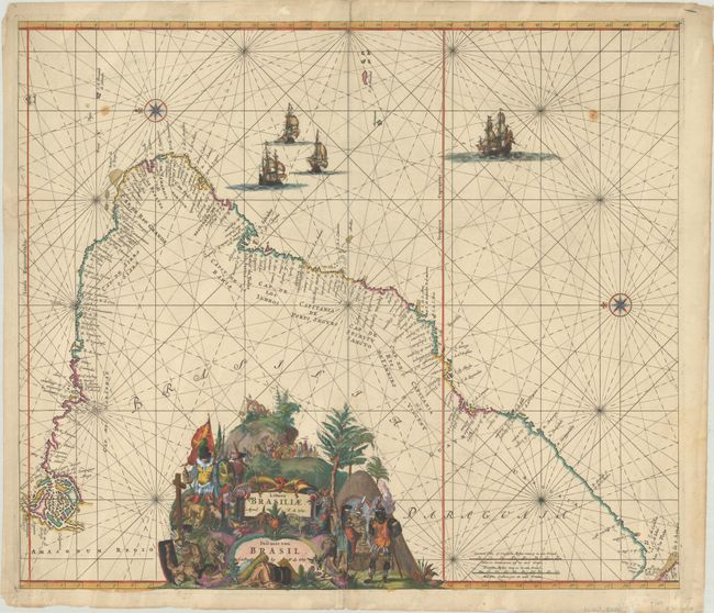
This magnificent map of Brazil is primarily a sea chart with details confined to the coastline. Oriented with north to the left by two fine compass roses, it covers the Brazilian coastline from the mouth of the Amazon to the Rio de la Plata in what is now Argentina. A dramatic title cartouche that fills the interior is constructed of a montage of scenes showing Portuguese and Dutch explorers and missionaries, an Indian ceremony, mining, exotic animals and produce, etc. Rhumb lines cross the entire map, which is further embellished by four sailing ships. This is the second state, with the removal of a lagoon in southern Brazil and the addition of the toponyms "Brasilia" and "Paraguay."
References: Carhart (De Wit) #C31.2.
Condition: B+
A crisp impression on a sheet with a "P" watermark, light soiling, small stains in the top corners, and archival repairs to a centerfold separation at top and a 1" tear at left. There are some tiny chips and tears along the edges of the sheet.