Subject: South America
Period: 1760 (circa)
Publication:
Color: Hand Color
Size:
37.4 x 22.5 inches
95 x 57.2 cm
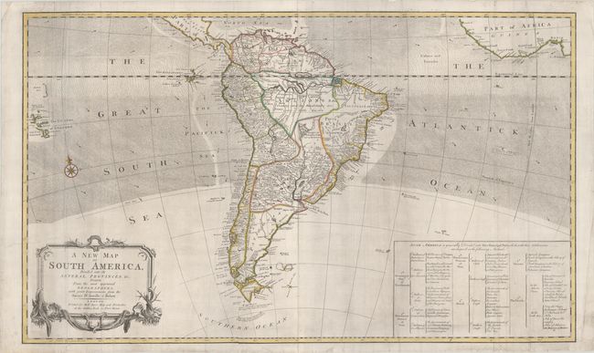
This uncommon two-sheet map of South America is based on the work of D'Anville and Robert de Vaugondy. Political boundaries are depicted and described in a large table in the south Atlantic. Place names are focused along the coastlines, with Patagonia and Brazil largely unexplored. The mythical Parime Lake and Larajes or Xarayes Lake are depicted in the interior. The map extends east to Africa and west to the Solomon Islands with directional lines and arrows denoting the trade winds throughout the oceans. A few notations of explorers' discoveries are also included, such as those of Le Maire and Captain Cowley.
References:
Condition: B+
A nice impression with contemporary outline color on bright sheets with light printer's ink residue. Professionally backed in archival tissue to repair a 3" tear adjacent to the Salomon Islands, a 6" and an 8" tear adjacent to the title cartouche, two short tears and a small hole in the south Atlantic (with small loss of image), and a few other minor chips and tears along the edges of the sheet, with a minor amount of the neatline replaced in facsimile at bottom right. As the repairs were done professionally they do not distract.