Subject: Gulf of Mexico & Caribbean
Period: 1638 (circa)
Publication: Theatre du Monde ou Nouvel Atlas…
Color: Hand Color
Size:
20.7 x 15.1 inches
52.6 x 38.4 cm
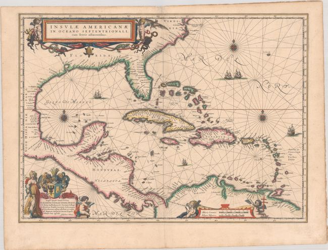
This fine map centered on the West Indies reflects the firsthand knowledge of Hessel Gerritsz during his voyage to South America and the West Indies undertaken in 1628. It covers the same region as the Gerritsz map of 1631; from Chesapeake Bay to the northern coastline of South America, with the addition of the west coast of Central America. The nomenclature in North America is virtually identical with the notable addition of the name Virginia. The nomenclature was probably derived from a Spanish chart as it lacks any French influence. The map is richly adorned with three lovely cartouches, sailing ships, rhumb lines and compass roses. French text on verso, published between 1638-43.
References: Burden #242; Van der Krogt (Vol. II) #9600:2B.
Condition: A
A crisp impression with contemporary outline color in the map and later color in the cartouches, on watermarked paper. There is marginal soiling and a short centerfold separation in top blank margin that has been archivally repaired.