Subject: Southwestern United States & Mexico, Texas
Period: 1841-42 (published)
Publication: Gilbert's Modern Atlas
Color: Hand Color
Size:
11.2 x 9.1 inches
28.4 x 23.1 cm
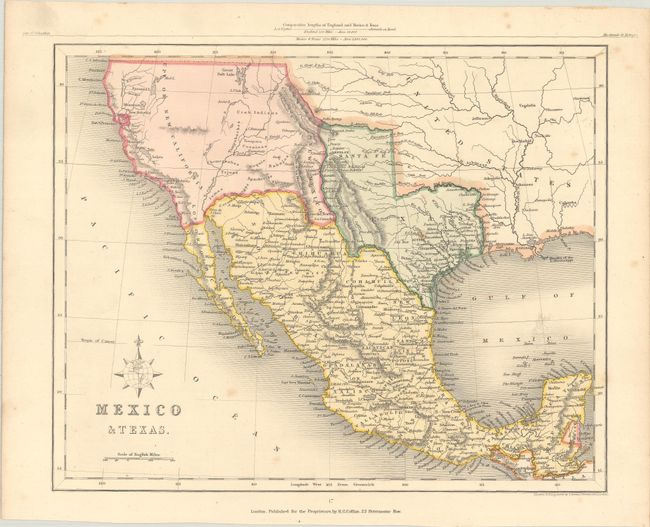
This small map shows the independent Republic of Texas with its wide panhandle reaching the Spanish Peaks and Arkansas River and including Santa Fe and Taos. New Mexico is reduced to a narrow corridor between the Rio Bravo and the Sierra de los Mimbres mountain range. Houston, Austin, Parker's Fort, Swartwout, Goliad, Refugio, Franklin, and Presidio de Altar are among the many place names in Texas. There is no hint of the Gold Rush in Upper or New California and most of the area between Texas and California is undefined, except for locating various Native American tribes. Above the title is a unique compass rose built around a globe focusing on the Western Hemisphere. In the upper margin is an interesting diagram of the comparative lengths of England and Mexico & Texas.
References: Phillips (Atlases) #780-47.
Condition: B+
Light scattered foxing.