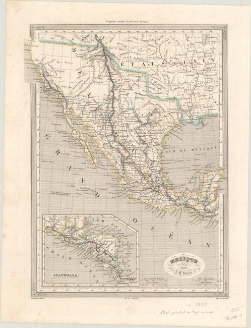
Subject: Southwestern United States & Mexico
Period: 1835 (circa)
Publication:
Color: Hand Color
Size:
10.2 x 13.6 inches
25.9 x 34.5 cm
An attractive and detailed map that depicts the Southwestern United States through Mexico to the Yucatan with an inset of Central America. Mexico extends north to the 42nd parallel and east to the Sabine River as established by the Adams-Onis Treaty of 1819. The provinces of Mexico are delineated and named, including Texas and "Nouveau Mexique." There are only a few place names identified in Texas including San Antonio, San Felipe and Nacogdoches. The Rocky Mountains are well delineated by hachure and incorporate information from Humboldt, Pike, and Long. The map predates Fremont, with two lakes in the vicinity of the Great Salt Lake and speculative rivers flowing across the Sierra Nevadas. Engraved by Grenier.
References:
Condition: B+
On a bright sheet with minor foxing mostly in the blank margins.