Subject: Texas, Gulf Coast
Period: 1852-56 (dated)
Publication:
Color: Black & White
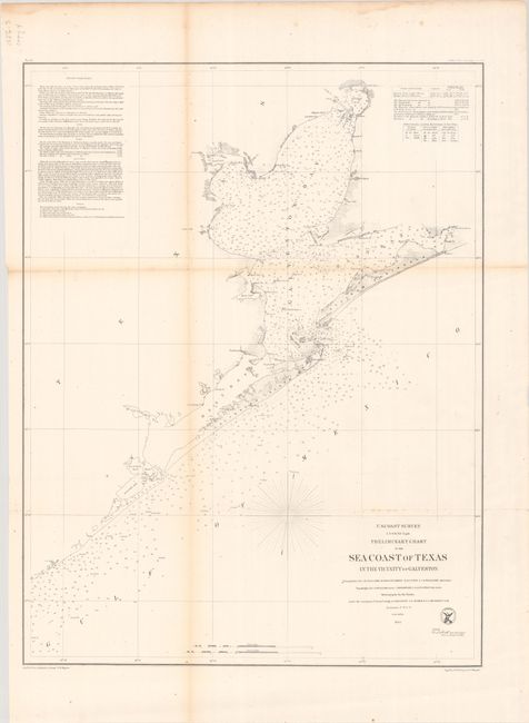
A. Preliminary Chart of the Sea Coast of Texas in the Vicinity of Galveston, dated 1856 (19.4 x 25.3"). This chart is centered on the city of Galveston, but continues northward to show the entire bay. It extends on the coast west beyond Oyster Bay, and east beyond Bolivar Peninsula to Muscle and East Bay points. Details include buoys and beacons, a light boat, shoals, reefs, and is filled with soundings, bottom types, extensive notations on sailing directions, tides, etc. In Galveston Bay, the mouth of the San Jacinto is depicted as is Turtle Bay. Condition: Issued folding with light toning along the folds and minor foxing. (B+)
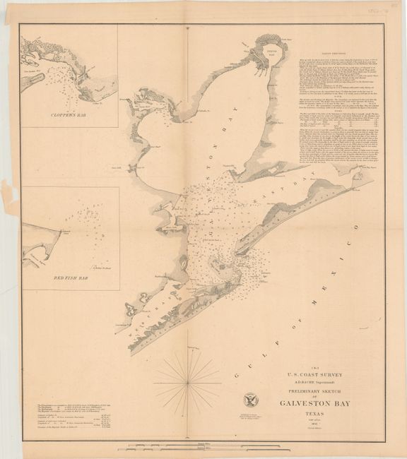
B. Preliminary Sketch of Galveston Bay Texas, dated 1852 (16.8 x 19.3"). The second edition of this handsome coastal chart shows the entire Galveston Bay with the city located at its entrance on Galveston Island. Includes insets of Clopper's Bar and Red Fish Bar. Extensive sailing instructions and the seal of the U.S. Coast Survey complete the chart. Condition: Issued folding on a lightly toned sheet with minor scattered foxing. There are a few chips and tears in the left blank margin. (B+)
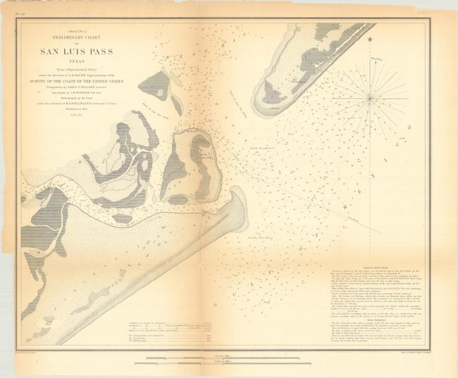
C. (Sketch I No. 4) Preliminary Chart of San Luis Pass Texas from a Trigonometrical Survey..., dated 1853 (17.1 x 13.8"). Handsome chart of the entrance to Galveston Bay, noting San Luis Island, Galveston, and Mud Island, as well as Peninsula Point. The chart notes soundings, sailing directions, and tidal effects. Condition: Issued folding with light toning along the folds and edges and fold separations, including a 9.5" vertical split at center that has been closed on verso with archival tape. There is a binding trim in the bottom left blank margin. (B)
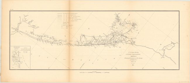
D. Sketch I Showing the Progress of the Survey in Section No. 9 1848 to 55, dated 1855 (21.5 x 7.5"). Presents the surveying progress along the coast from Corpus Christi to Galveston. Condition: Issued folding with light toning along one fold and a few spots of foxing. (B+)
References:
Condition:
See description above.