Subject: Southern Texas
Period: 1849 (dated)
Publication: Sen. Ex. Doc. 64, 31st Congress, 1st Session
Color: Hand Color
Size:
36.6 x 24.6 inches
93 x 62.5 cm
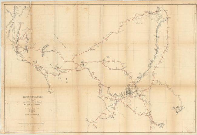
This map covers the region of Texas from the Rio Grande east to include Matagorda Bay, Preston and Fort Washita. There is good detail along routes, especially around San Antonio de Bexar, and mostly blank elsewhere. Shows a reconnaissance of 1849 in red and Lt. Whiting's route in blue. It is filled with geographical information, forts, presidios, springs, fords, watering holes and much more. A fascinating and historical map which is mostly uncolored save for fine coloring along the routes.
References: Wheat (TMW) #677.
Condition: B
Issued folding with light toning and scattered foxing. There are archival repairs to several small fold separations and a long tear at top left. Small loss along the top left vertical fold is mostly confined to blank areas.