Subject: Oklahoma
Period: 1900 (circa)
Publication:
Color: Hand Color
Size:
8.2 x 8.4 inches
20.8 x 21.3 cm
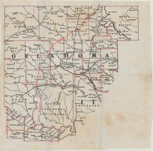
This pre-statehood manuscript map was drawn on onionskin and apparently drafted while Indian Territory and Oklahoma were separate territories. The Oklahoma portion of the map shows only one railroad and has not been fully divided into counties with a large area of Indian lands in the south not organized. Other counties, including Greer, Woodward and Woods, show boundaries that were changed at statehood in 1907 as more counties were created from them. The county seat of Washita still is shown as Cloud Chief (an act of Congress changed the county seat in 1906). Only the southwestern tip of Indian Territory (here "I.T") is shown to the south of the Canadian River in what would become Curtis County in the proposed state of Sequoyah in 1905 and ultimately part of Grady County in 1907.
The map came from the estate of an army officer, Major John A. Long, whose involvement in Oklahoma at the time is not known.
References:
Condition: B+
Issued folding with light scattered foxing and one small route drawn in pencil.