Subject: New Jersey
Period: 1800 (circa)
Publication:
Color: Black & White
Size:
12.2 x 18.4 inches
31 x 46.7 cm
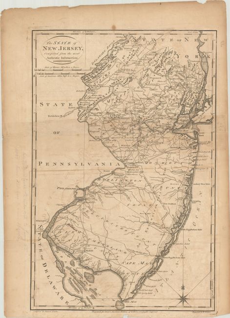
Handsome topographical map showing counties, the division line of East from West Jersey, towns, mills, courthouses and many roads. Carey's American Atlas was originally issued in 1795 to accompany the American edition of Guthrie's Geography Improved, and it was subsequently issued into the early nineteenth century. There is no plate number on the map, but has a manuscript number 32 on verso, suggesting it was published in Carey's General Atlas in 1800. Compiled by Samuel Lewis and engraved by W. Barker.
References: Wheat & Brun #414.
Condition: B
Issued folding with moderate toning and offsetting. There are minor edge chips and tears confined to the blank margins and pencil notations in the left blank margin.