Subject: New Orleans, Louisiana
Period: 1757 (circa)
Publication: Prevost's L'Histoire Generale des Voyages
Color: Hand Color
Size:
11 x 7.8 inches
27.9 x 19.8 cm
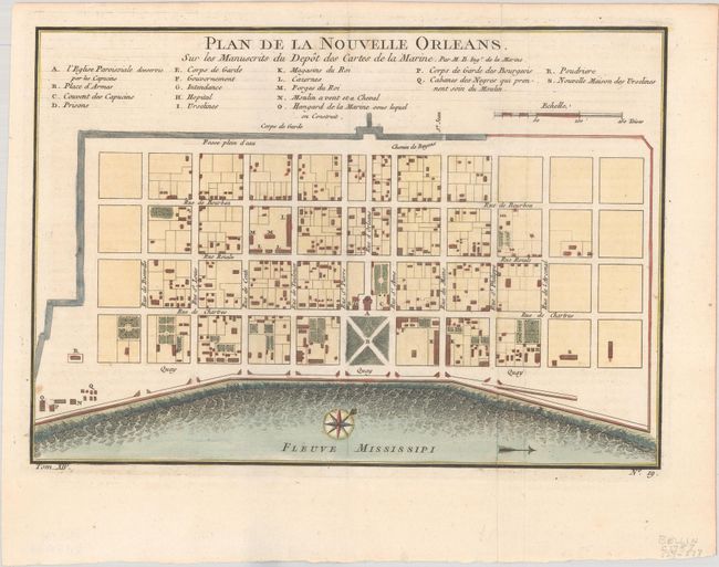
This attractive copper-engraved plan of the city of New Orleans details the city center including Bourbon Street. Individual buildings are depicted and keyed to a list under the title naming 18 buildings. The plan locates the quay along the Mississippi River, the canal, government buildings, a church, a prison, a hospital, a monastery, and Army and Navy quarters. Bellin's plan was first issued in Charlevoix's History and General Description of New France in 1742 with later versions, such as this, used in several publications. The plan became the standard map of New Orleans throughout the eighteenth century.
References: Lemmon, Magill & Wiese #171.
Condition: A
Gorgeous early impression with text layout lines clearly visible, issued folding on a bright sheet with a tiny fleur-de-lis watermark and minor mis-folding.