Subject: Chicago, Illinois
Period: 1933 (dated)
Publication:
Color: Printed Color
Size:
25.5 x 17.7 inches
64.8 x 45 cm
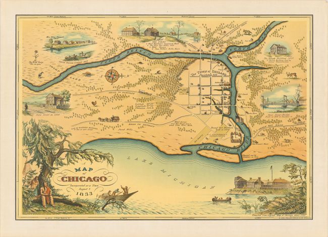
This charming pictorial map commemorates the centenary of Chicago's founding and was perhaps published to coincide with the Chicago World's Fair of 1933. It was designed by Walter Conley and drawn by O.E. Stelzer, based on accounts from the last living pioneers of Chicago compiled by Caroline McIlvaine, a librarian, curator, and acting secretary of the Chicago Historical Society. The map depicts the town of Chicago in plan form as it was in 1833, with a population of only 350. Illustrations show historical sites such as Eliza Emily Chappell Porter's school, State Street, the second Fort Dearborn, and the city's first drawbridge. Roads, forests, wildlife, and individual houses are depicted in the surrounding landscape. Along the bottom of the map is an evocative scene of Native Americans seated in the shade while a fur trapper boat and canoe glide across the water to Fort Dearborn. A decorative compass rose orients north to the right.
References:
Condition: A
A bit of toning and extraneous creasing along the sheet's edges, otherwise fine.