Catalog Archive
Auction 187, Lot 234

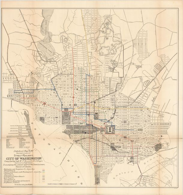
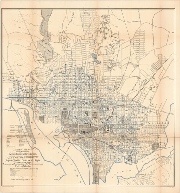
"[Lot of 2] Statistical Map No. 10. Showing the Locations of Street Railways, City of Washington [and] Statistical Map No. 6 Showing the System of Water Supply & Distribution, City of Washington", U.S. Corps of Engineers

Subject: Washington, D.C.

Period: 1891 (dated)

Publication:

Color: Printed Color

Size:
28 x 28.2 inches
71.1 x 71.6 cm
Download High Resolution Image
(or just click on image to launch the Zoom viewer)

These two maps were part of a 12 map set published to show the large-scale improvements in the infrastructure of the city since the Greene maps of 1880. They were prepared by Capt. W.T. Rossell of the Army's Corps of Engineers to accompany the annual report of the Commissioners, District of Columbia. Both maps carry the title “Statistical Map No. –“, are drawn on identical scales, and show street railways and the water supply system with color-coded keys at bottom. In addition to the infrastructure, the maps highlight the National Mall, locating the Executive, Monument, Smithsonian and Capitol Grounds. Lithographed by Norris Peters Co.

References:

Condition: B

Issued folding with light toning along the fold lines and numerous fold separations that have been closed on verso with a combination of both archival and non-archival materials.

Estimate: $150 - $180

Sold for: $110

Closed on 4/27/2022

Archived