Subject: Los Angeles, California
Period: 1943 (dated)
Publication:
Color: Printed Color
Size:
46.6 x 23.3 inches
118.4 x 59.2 cm
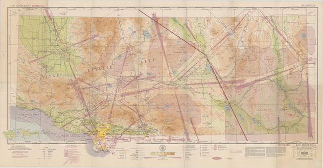
This fascinating World War II era aeronautical chart was created for civil aviators navigating through the complex airspace of the Los Angeles region. The map extends from Santa Barbara and Los Angeles east to the border with Nevada and Arizona. Much the region is identified as a "Vital Defense Area" with shaded regions identifying danger areas, prohibited areas, tunnel areas, and radio ranges for various stations throughout. In addition to the airways, the map presents excellent detail at ground level including elevation gradients, transmission lines, oil derricks, lookout towers, Coast Guard stations, and more. Dated August 12, 1943 with warning: "Due to war conditions, lights, radio facilities and other aids to air navigation may be changed or discontinued without notice."
References:
Condition: B+
A colorful example, issued folding, with some minor toning and soiling in the top left and bottom right fold panels.