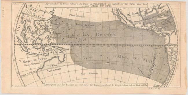
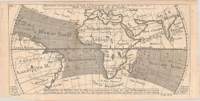
Subject: World
Period: 1753 (published)
Publication: Prevost's Histoire Generale des Voyages
Color: Black & White
Size:
11.7 x 5.9 inches
29.7 x 15 cm
These rather early thematic maps depict the wind currents across the world's major shipping routes, showing the world on an unusual oval projection. Both maps are centered on the equator and depict the currents by means of engraved directional lines. The trade winds are shown with little arrows, augmented with the names of months. The first map focuses on the Pacific and shows a portion of North America with the island of California and partial coastlines for Australia. The second map displays the winds across the Atlantic and Indian Oceans. This pair of matched maps was engraved by Cosmant. Most of the maps in Prevost's work are by Jacques Nicolas Bellin, but these maps do not contain any attribution.
References: Mickwitz & Miekkavaara #638, vol. XI, map 9 & 10.
Condition:
Both maps are issued folding with faint offsetting. The Pacific map is in A condition with a light dampstain in the right blank margin. The Atlantic and Indian oceans map is in B+ condition with light foxing and small dampstains in the top blank margin.