Subject: World
Period: 1746 (dated)
Publication:
Color: Hand Color
Size:
21.9 x 18.4 inches
55.6 x 46.7 cm
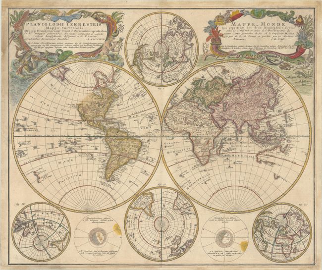
This handsome double-hemisphere world map was drawn by Georg Moritz Lowitz, based on the work of Johann Mathias Haas. It includes four polar spheres, each in a different projection, and two interesting diagrams depicting the earth, as it would be seen from space. North America is still blank above California and Hudson Bay is open-ended in the northwest corner. The large, mythical Xarayes Lake appears in the center of South America. In the South Pacific there are partial coastlines of New Zealand, Australia, and Tasmania. Two very large, decorative cartouches contain the titles, one in Latin, the other French. The Latin cartouche features mythical sea creatures and wind heads while the other is surrounded by fruit and animals representing the bounty of the earth along with four headdresses representing the four continents.
References:
Condition: B+
Contemporary color in the map with later color in the cartouches. There is light soiling and the margins at top, bottom and right have been professionally extended to accommodate framing.