Subject: Southwestern United States
Period: 1858 (dated)
Publication: Geological Report of the Colorado Exploring Expedition…
Color: Hand Color
Size:
34.8 x 14.7 inches
88.4 x 37.3 cm
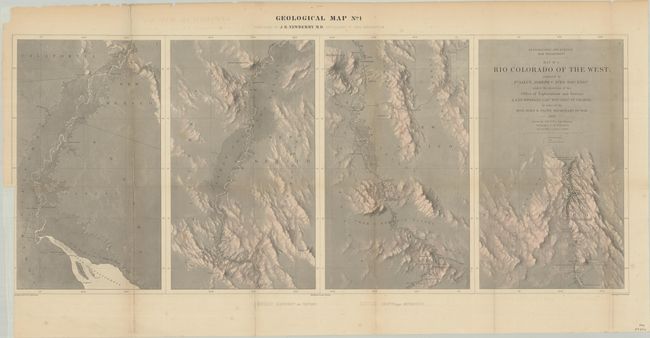
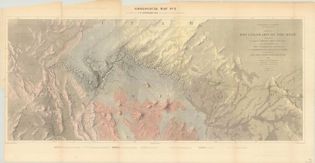
This uncommon pair of maps represents the earliest geological maps of the Grand Canyon region prepared as part of one of the most important exploring efforts of the American Southwest. Ives published his explorations in a series of four maps, two topographical and two geological; these being the scarcer geological maps. In his book Mapping of the Trans-Mississippi West, Carl Wheat devotes several pages to the topographical versions of these maps saying they are two of the best created by the remarkable F.W. von Egloffstein. They were engraved using his system that imparts the appearance of depth to the topography and nearly mimics a satellite image. A remarkable accomplishment for the time. The maps were prepared by J.S. Newberry M.D., Geologist to the Expedition, with topography by von Egloffstein and lettering by F. Courtenay. Each approximately measures the size given as listed.
References: Marcou & Marcou #784.
Condition: B
Issued folding with light scattered foxing and several small fold separations that have been closed on verso with archival materials. There are binding trims along the left edge, and the second map is chipped in the top left blank margin. The first map has been backed with tissue.