Catalog Archive
Auction 187, Lot 203

Freyhold's Updated & Enlarged Version of Warren's General Map

"[On 6 Sheets] Map of the Territory of the United States, West of the Mississippi River. Prepared by Authority of the Hon. the Secretary of War...", U.S. Army

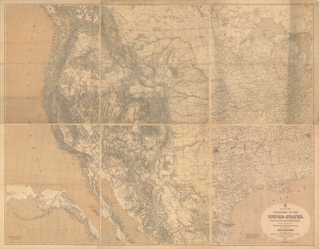
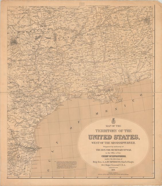
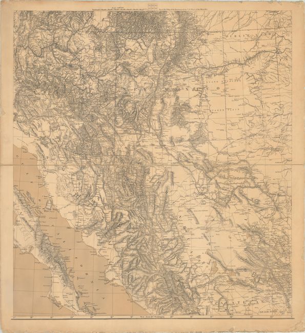
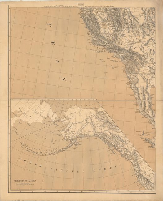
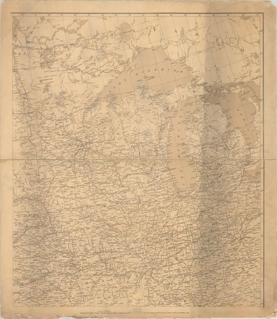
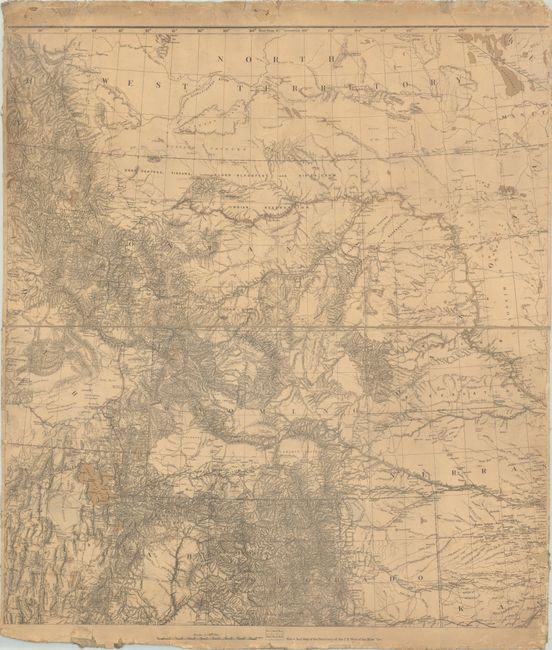
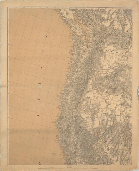
Subject: Western United States

Period: 1879 (dated)

Publication:

Color: Black & White

Size:
26.5 x 31.3 inches
67.3 x 79.5 cm
Download High Resolution Image
(or just click on image to launch the Zoom viewer)

This incredibly detailed military map on six sheets was prepared with the latest information provided by the War Department through the 1870's. Compiled by Edward Freyhold, the map was made under the direction of General Andrew Atkinson Humphreys, who served as Chief Engineer of the U.S. Army before being promoted to a Union General in the American Civil War. The map covers the western two-thirds of the United States from Alabama, Tennessee, Kentucky, and Ohio to the West Coast. According to Wheat, the map was "a major new revision" of Freyhold's smaller map of 1868, Territory Of The United States From The Mississippi River To The Pacific Ocean, which itself was "the first major revision of Lieutenant Warren's general map of 1857." Freyhold's maps were the most detailed and modern maps of the western states of its time. Wagon roads, railroads, and telegraph lines are shown, illustrating the westward advancement of communication and economic prospects. It is also filled with intricate topography and watershed information. Despite the complexity of the cartography, the map is quite beautiful, with Wheat describing Freyhold's first map as "a superb example of the mapmaker's art, as well as his science." Each sheet is dissected into an upper and lower half and backed with linen. If assembled, the full map would measure approximately 79 x 62". We located only one past sales record in the last 30 years for a partial set sold here at Old World Auctions (click here for that listing).

References: Rumsey #3359.007; Wheat (TMW) #1295.

Condition: B

The maps are backed with linen and have minor soiling, some extraneous creases along the sheet edges, numerous small edge tears and chips, and some fraying of the linen along the sheet edges. Sheet #1 has a small chip in the Pacific Ocean; Sheet #2 has a small hole at upper right, small chip at lower right, and some extraneous creasing at lower left; Sheet #3 has moderate soiling along the right side. The southern half of the map (sheets #4-6) is overall very good (B+), while the northern half (sheets #1-3) is good (B). The first image is a composite image - the map is in six separate sheets.

Estimate: $3,500 - $4,250

Sold for: $14,500

Closed on 4/27/2022

Archived