Subject: Colonial Southern United States
Period: 1732 (circa)
Publication: Atlas Minor
Color: Hand Color
Size:
10.8 x 7.9 inches
27.4 x 20.1 cm
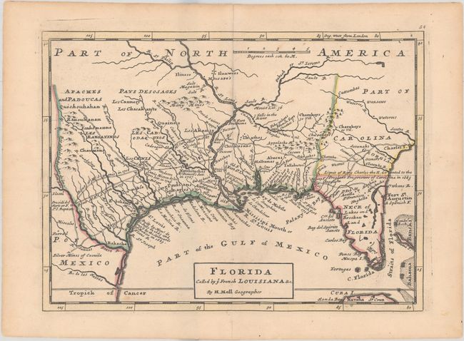
This map is based on Moll's larger map of 1720 and portrays the Gulf Coast and Florida with detail of Indian villages, missions, mines and forts. It is one of the earliest printed maps to describe the roads and trading paths in the region. It is also filled with interesting notations including notes on La Salle's landing in Texas in 1685, the Cenis Missions and early Texas settlements in 1716-17, and the limits of King Charles II's Grant to the Lord Proprietors (Carolina) in 1663. This edition has the erroneous apostrophe in calle'd in the title removed.
References: Cumming (SE) #201, Phillips (A) #574.
Condition: A
Contemporary outline color with a few faint spots and short centerfold separations at top and bottom confined to the blank margins.