Subject: Colonial Southern & Central United States
Period: 1760 (published)
Publication: British Magazine
Color: Black & White
Size:
8.5 x 7.3 inches
21.6 x 18.5 cm
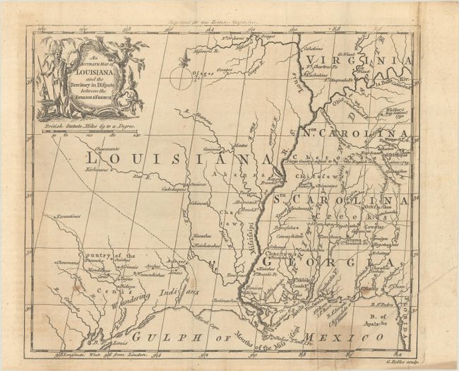
An unusual map of the Mississippi River valley and the Gulf Coast made towards the end of the French and Indian War. It shows the colonial holdings in the southern portion of the continent that were disputed and finally resolved by the Treaty of Paris in 1763. The British colonies of North and South Carolina, Virginia and Georgia are shown with their western borders on the Mississippi River. A note across them states they are a Territory in Dispute. The region west of the Mississippi is labeled Louisiana with several Indian nations located. Present-day Texas is labeled Country of the Cenis and Wandering Indians. This is only the second time we have encountered this map, the last time being in 2008.
References: Jolly #BRITB-2.
Condition: B
Issued folding with light toning, some extraneous creasing at right, and a few spots of foxing. An old tape repair at bottom right has been removed and replaced with archival tape with a small stain visible on recto.