Subject: Colonial Southeast United States
Period: 1749 (dated)
Publication: Atlas Portatif Universel et Militaire
Color: Hand Color
Size:
6.9 x 6.6 inches
17.5 x 16.8 cm
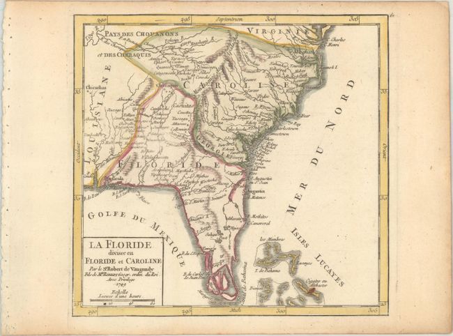
This rarely seen map depicts the Southeastern United States as far west as Mobile Bay and north to the border between Carolina and Virginia. The Florida peninsula is fragmented into several large islands. Florida has a large extension that completely cuts off Georgia leaving it as only a small sliver on the coast. Louisiana is to the west and Carolina occupies a large area north. Locates Pensacola, St. Augustine, Beaufort, Charlestown, and the forts George, Argile, First, Conde, and more. There are many early settlements and forts named. Includes the northern portion of the Bahamas Islands. Page number 61 engraved above neatline.
References: Pedley #472.
Condition: A
A crisp impression with a small paper flaw in the Bahamas and light toning along the edges of the sheet.