Subject: Colonial Eastern North America & Caribbean
Period: 1719 (published)
Publication: Atlas Historique…
Color: Black & White
Size:
20.8 x 16.3 inches
52.8 x 41.4 cm
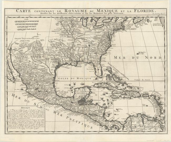
This is a derivative of Delisle's landmark map of the southern part of North America and the West Indies. The detailed map shows many English settlements along the East Coast and carefully notes the discoveries of D'Iberville along the Gulf Coast and Mississippi River. The vast region, later known as Louisiana, from Florida through present-day Texas is shown as the French possession of Floride. There is also a great amount of detail in Nouveau Mexique, particularly of the Spanish missions: Santa Fe, Taos, and Acoma.
Included with this example is the 10-page chapter of text (Premiere Dissertation sur le Mexique, ou la Nouvelle Espagne) that accompanied this map in Chatelain's atlas.
References: Koeman, Cha 7 #9; Martin & Martin, p. 93.
Condition: A
A dark impression on a bright sheet with just a hint of toning along centerfold. The tops of the side margins have been extended slightly to better accommodate framing. The text pages have a light dampstain that covers 2/3 of each page.