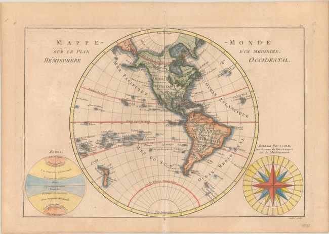
Subject: Western Hemisphere - America
Period: 1788 (circa)
Publication: Atlas Encyclopedique
Color: Hand Color
Size:
13.6 x 9.3 inches
34.5 x 23.6 cm
Fine copper engraving shows North and South America with the Atlantic and Pacific Islands and New Zealand. Alaska is approximately the correct shape reflecting Cook's discoveries. At bottom right is a large wind rose called "Rose de Boussole," showing wind directions taken from charts in use in the Mediterranean Sea. A second diagram in the lower left corner balances the composition, with information on the poles and the circles of the earth. Engraved by Andre under the direction of Rigobert Bonne (1727-1795), the Director of the Depot de la Marine and Royal Hydrographer to the King, the map was published with Nicolas Demarest in his "Atlas Encyclopedique" in 1788.
References:
Condition: B+
A light toned sheet with minor offsetting.