Subject: Western Hemisphere - America
Period: 1784 (circa)
Publication:
Color: Hand Color
Size:
21.5 x 19.6 inches
54.6 x 49.8 cm
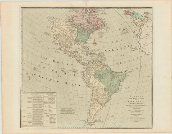
This large map covers the Americas with an extensive key to the colonial possessions. In North America the United States extends to the Mississippi River, and there are 14 states listed. Spain is shown in control of the entire western part of North America and Florida. The British possessions in Canada extend only to the Lake Winnipeg region, and France retains only a small sliver of Newfoundland. In South America, Spain and Portugal dominate the continent. There are a number of interesting notations including several regarding the search for a Northwest Passage and one that notes that California was once believed to be an island. The Sea of the West is named as The West Sea but not delineated. Despite the title, this is not a pocket map; it was printed on a sturdy sheet and issued in atlas form.
References:
Condition: A
Contemporary color on a sheet with a large coat of arms watermark. There are a few edge tears that have been repaired on verso with archival materials.