Subject: References, British Isles
Period: 1988-91 (published)
Publication:
Color: Black & White
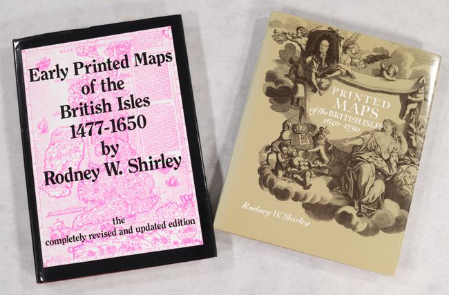
A. Early Printed Maps of the British Isles 1477-1650, published 1991 (8.6 x 12.0"). This is completely revised and reset edition of this reference, which traces the cartographic history of the British Isles from Ptolemy to Speed. This updated version includes 670 entries (like the 1980 edition) and 160 black & white plates (88 in the 1980 edition). 233 pages. Hardbound in maroon cloth with gilt titles on front cover and spine. An invaluable reference for collectors of maps of the U.K.
B. Printed Maps of the British Isles 1650-1750, published 1988 (8.9 x 11.1"). This is a sequel of sorts to Shirley's classic reference tracing the early cartographic history of the British Isles. Whereas his book covering 1477 to 1650 was organized chronologically, this volume is organized by cartographer from anonymous cartographers and Pieter van der Aa to Frederick de Wit. It covers more than 280 maps in all, many of them accompanied by B&W illustrations. The book also includes brief biographical sketches of nearly 70 notable cartographers, 6 appendices, and 3 indexes. An invaluable reference for collectors of maps of the U.K. Hardbound in golden-tan cloth with gilt titles on the spine and an illustrated dust jacket. 168 pp.
References:
Condition: A
Both like new except the book jacket spine is sunned on the second volume.