Subject: Geography Books
Period: 1797 (published)
Publication:
Color: Black & White
Size:
5.5 x 8.7 inches
14 x 22.1 cm
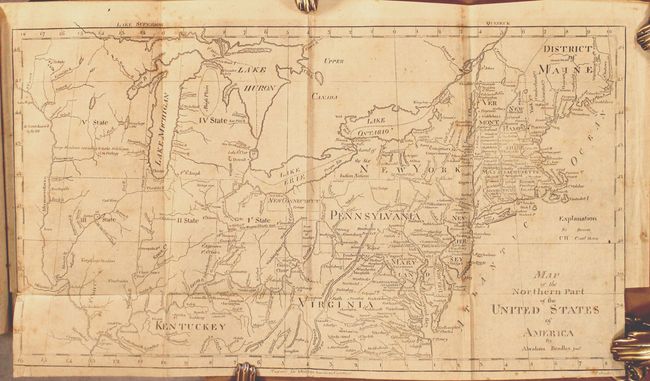
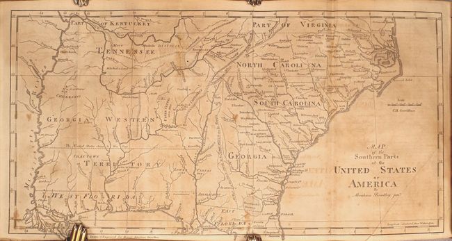
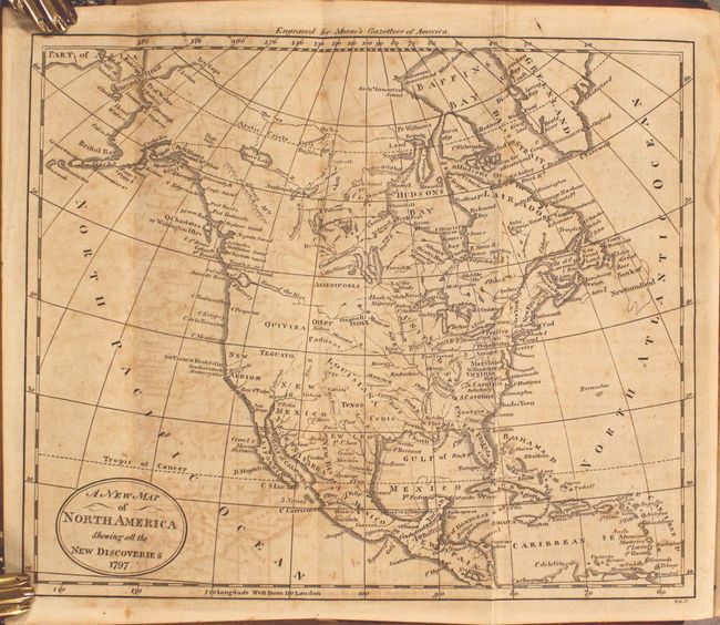
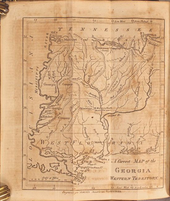
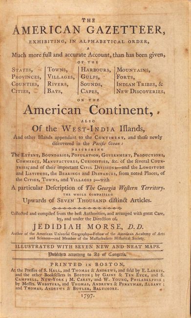
This is a first edition of this early American geography book that is considered to be the country's first gazetteer. The volume contains seven folding maps, including the Georgia Western Territory map which is not present in all copies. An example of the young country's anxious desire to expand westward can be seen on the Map of the Northern Part of the United States, which shows several numbered designations for future states in the upper Midwest. This particular map also shows northern Ohio as New Connecticut. The populations of the states, cities and towns are reported according to the fledgling nation's first official census in 1790. The list of maps:
A. A New Map of North America Shewing all the New Discoveries. Condition: Light toning and foxing with moderate offsetting. (B)
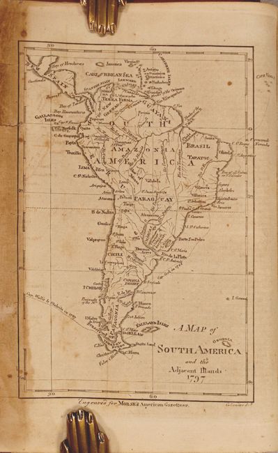
B. A Map of South America and the Adjacent Islands. Condition: Light toning, offsetting and foxing in the image. There is heavy toning at far left with some small chips and tears that have been archivally repaired on verso. (B)
C. A Correct Map of the Georgia Western Territory. Condition: Moderate toning and offsetting. (B)
D. Map of the Northern Part of the United States of America by Abraham Bradley Junr. Condition: Light toning and foxing with binding trims in the bottom corners and a short binding tear at left that has been archivally repaired. The edges of the sheet have been professionally reinforced on verso with archival tissue. (B+)
E. Map of the Southern parts of the United States of America by Abraham Bradley Junr. Condition: Light offsetting with scattered foxing and heavy toning. (B)
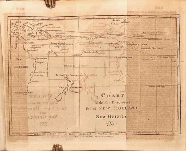
F. Chart of the New Discoveries East of New Holland and New Guinea. Condition: Heavy toning and offsetting. (C+)
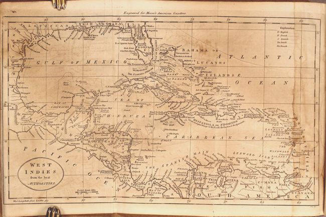
G. West Indies from the Best Authorities. Condition: Moderate toning and offsetting with dampstaining at right. The left edge of the sheet has been professionally reinforced on verso with archival tissue. (B)
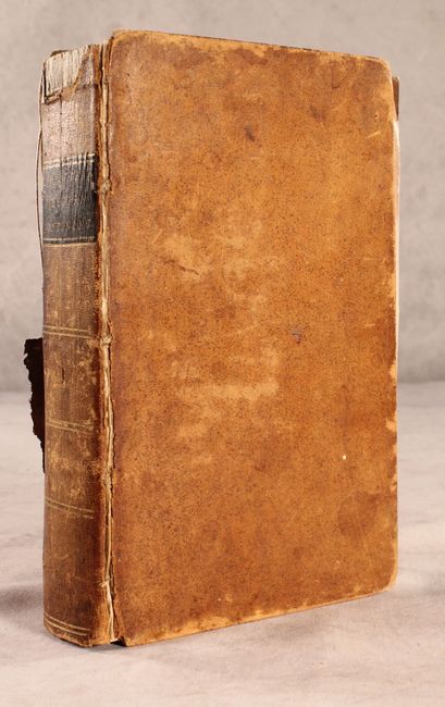
8vo. Complete. Published in Boston by S. Hall and Thomas & Andrew. Hardbound in full original leather with original black leather label with gilt title on the spine.
References: Howes #M-839; Wheat & Brun #60, 244, 496, 618, 699, 714, 911.
Condition: B
See description above for details on each map. The text has light to moderate toning and the title page has offsetting from the facing map. The hinges are nearly perished. The front cover has some abrasions and the back cover is missing half of the leather, with the remaining leather partially detached. The spine also has some abrasions and a chip at top.