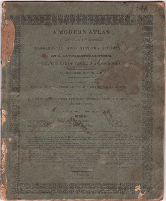
Subject: School Atlas
Period: 1826 (dated)
Publication:
Color: Hand Color
Size:
8.8 x 10.8 inches
22.4 x 27.4 cm
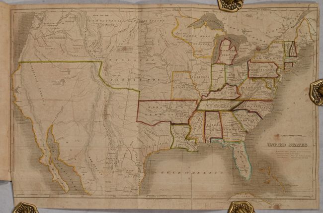
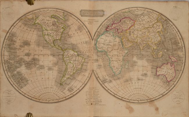
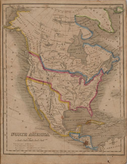
This small school atlas contains 9 maps including a double-page world map, North America, South America, Europe, British Isles, Asia, Africa, Palestine, and folding map of the United States (18.5 x 11.5"). The U.S. map shows Arkansas Territory in its largest extent including present-day Oklahoma, Missouri as both a state and large territory, and the Territory of Columbia in the Pacific Northwest. Texas is named and part of Mexico, and Galveston is very misplaced in eastern Texas close to the Sabine River. The west coast is labeled "Unexplored Country" and a river is shown running a speculative course from an unnamed lake in the Great Basin to the Pacific Ocean. Blue paper wrappers. A scarce item that we have only encountered once before.
References: Rumsey #1631.
Condition: B
Contemporary outline color with toning and scattered foxing. The folding map of the United States also has a 2" fold separation at bottom that has been closed on verso with archival tape. Covers are worn and stained, chipped along the joint, and there are some wormholes at bottom.