Subject: Atlases
Period: 1863 (published)
Publication:
Color: Hand Color
Size:
13 x 15.8 inches
33 x 40.1 cm
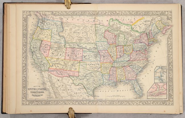
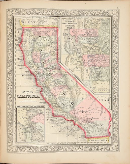
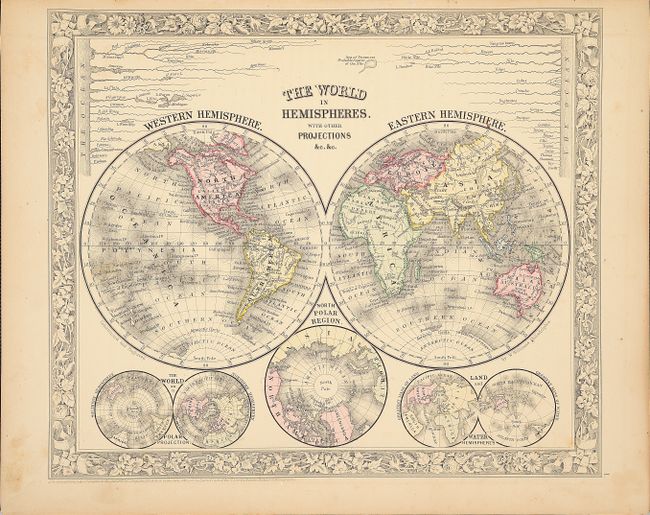
This is a nice example of Mitchell's world atlas produced during the Civil War. It is complete with 84 maps and plans on 53 sheets, each surrounded by Mitchell's signature floral border (the pagination is slightly different from the list of maps). There are 28 map sheets related to the United States including 38 individual states and territories, regions and city plans. There are two world maps - one hemispheric and the other drawn on Mercator's Projection.
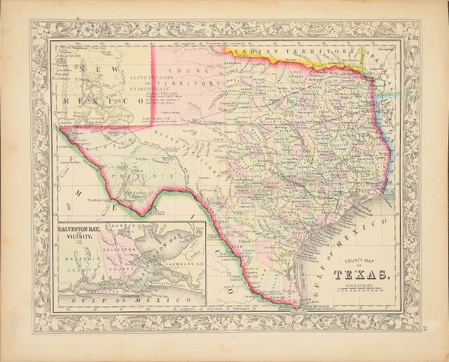
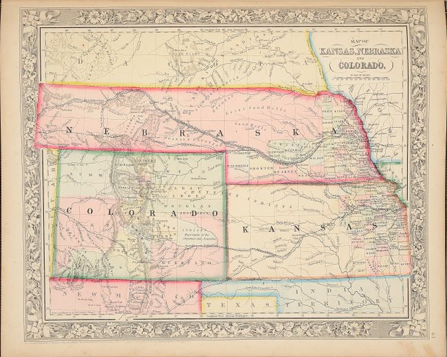
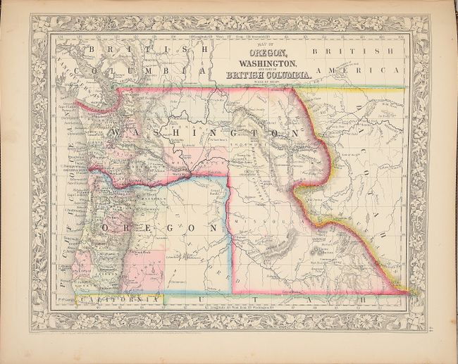
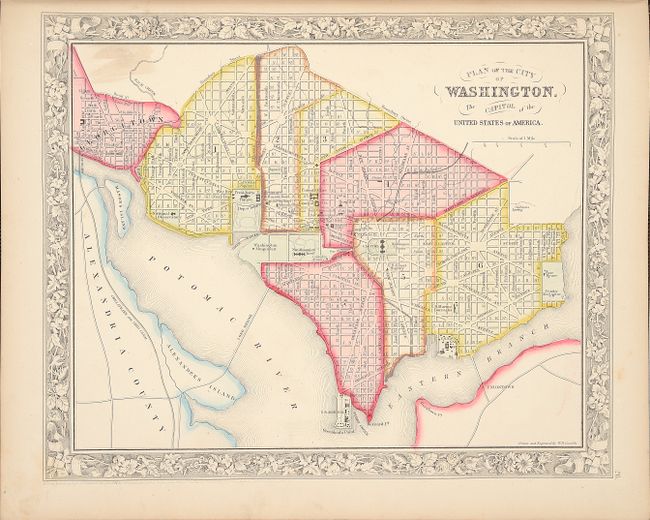
The map of Texas shows county development to 100° longitude with the large regions of El Paso, Presidio and the Bexar Territory further west. The Staked Plain is now called Young Territory. The Map of Kansas, Nebraska and Colorado locates the Gold Region surrounding Denver City. The map of the Northwest shows Idaho still attached to Washington Territory, resulting in an odd-looking inverted-L shape. The Pony Express route is delineated on the map of the United States as are numerous routes of exploration, important trails including the Santa Fe, numerous wagon roads, the Overland Mail Route to California, and early railroads. This 1863 edition did not include the separate map of Arizona and New Mexico, however on the U.S. map the southern tip of Nevada is contained as part of the New Mexico Territory and Utah encroaches a full degree into Nevada. Arizona occupies the southern portion of New Mexico Territory, suggesting a Confederate Territory of Arizona. The atlas also includes full-page plans of the cities of Boston, New York, Philadelphia, Baltimore, Washington, New Orleans and Cincinnati. All maps carry the 1860 copyright date.
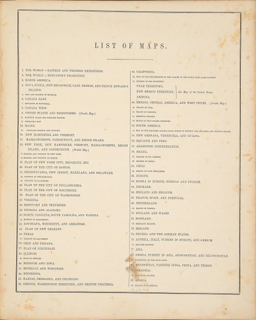
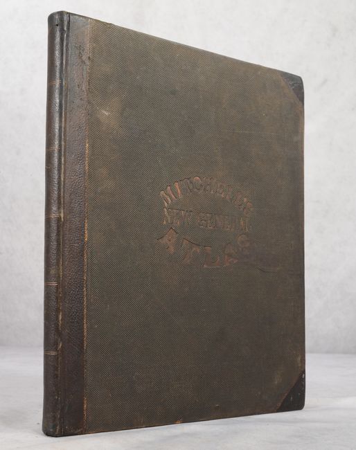
Hardbound small folio, publisher's half calf with cloth covered boards, stamped title on front cover. Title page, List of Maps, maps and plans are followed by 23 pages of text: List of Post Offices in the United States, Population of the United States by the Census of 1850 and 1860, List of Post Offices in Canada, Table of Population, Governments. &C., Mountains of the World, and Rivers of the World. A nice example of this historical and desirable atlas.
References:
Condition: B+
The maps are in contemporary color with very light toning and occasional soiling. The maps of Georgia, the Carolinas, and Louisiana have a 1" stain at bottom right, and there are some ink stains on the map of Ilinois. The title page and list of maps have foxing and moderate soiling. There are pencil notations on the endpapers. The covers have some moderate stains and light wear. A nice example that has a reinforced binding.