Subject: Atlases
Period: 1675 (circa)
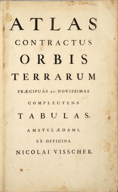
Publication:
Color: Hand Color
Size:
12.8 x 20.4 inches
32.5 x 51.8 cm
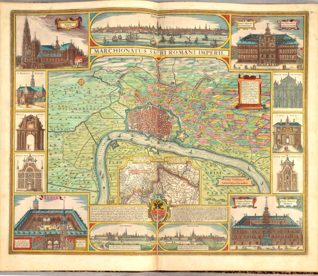
This superb world atlas includes 56 folio maps, as called for in the list of maps, as well as two additional maps bound in at the end of the volume, for a total of 58 double-page maps. The majority of the maps are by Nicolas Visscher, however there are also 10 maps by Claes Janszoon Visscher, 9 by Jan Jansson, 4 by Frederick de Wit, and the two bonus maps are by Henricus Hondius. Atlas Contractus was published with variable content by the younger Visschers beginning in the 1670s, and often included maps by other publishers. This edition includes a printed list of maps with the map numbers added in manuscript both on the index and on each map itself. The maps in this edition are of the world, 4 continents, Gulf of Mexico & Caribbean, Southeast Asia, Middle East, and 48 regional maps of Europe. The two extra maps at the end of the volume are of Flandria, which show part of Belgium and northern France. Some of the notable maps include:
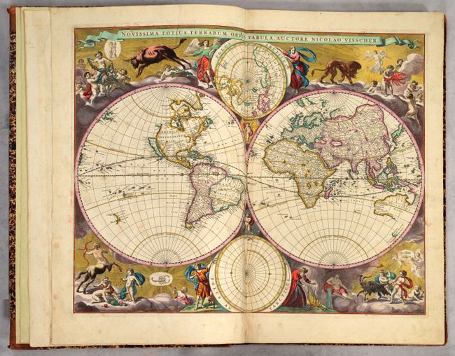
A. Novissima Totius Terrarum Orbis Tabula. This is an uncommon double-hemisphere map featuring the island of California with a flat northern coast and a single, large Great Lake. Anian appears adjacent to a strait leading within striking distance of the western shores of Hudson Bay. In China, stippling is used to denote a desert, Xamo Desertum, just west of the Great Wall. Tucked between the cusps of the hemispheres are north and south polar spheres. The unique corner decorations feature superb engravings of the signs of the zodiac accompanied by cherubs and angels. The map is geographically based on the elder Visscher's map of 1658. Reference: Shirley #486.
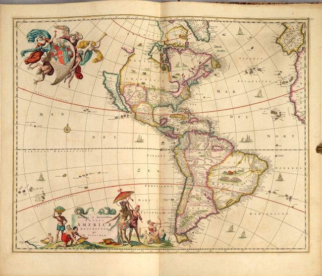
B. Novissima et Accuratissima Totius Americae Descriptio. Visscher's map greatly influenced the cartography of the Americas both geographically and artistically. One of the most distinctive geographic details copied by other cartographers is the large open lake in the Great Lakes region. Visscher actually copied this from Blaeu's wall map of the world [1648], but popularized it on this map. California is shown as an island, on the Briggs model, but with a broader northern coastline. The map is embellished with two large cartouches that were also copied by other cartographers. The top cartouche features a dedication to Cornelius Witsen and depicts angels struggling with a devil for the soul of a Native American. The pictorial title cartouche contains scenes of gold panning, hunting and a native chief standing beneath an umbrella. Reference: Burden #332.
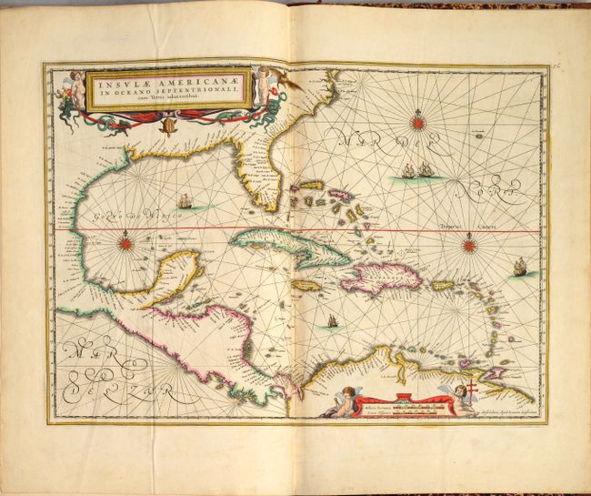
C. Insulae Americanae in Oceano Septentrionali cum Terris Adiacentibus. This handsome map focuses on the West Indies and covers the region from the Chesapeake through the Gulf of Mexico, with Central America and the northern part of South America. Two lovely cartouches with cherubs and mermaids decorate opposite corners. Eight ships sail the seas, and three native canoes are depicted off the coast of North America. A number of interesting cartographic myths appear on the map. These include two large nonexistent lakes in the region of western Georgia and a non-existent mountain range extending from the Piedmonts bearing across the North American continent. In South America, the archetypal cartographic myth, Manoa o' El Dorado (the golden city), is located on the shores of the Lacus Parime vel Roponowini in Guyana. Reference: Burden #531.
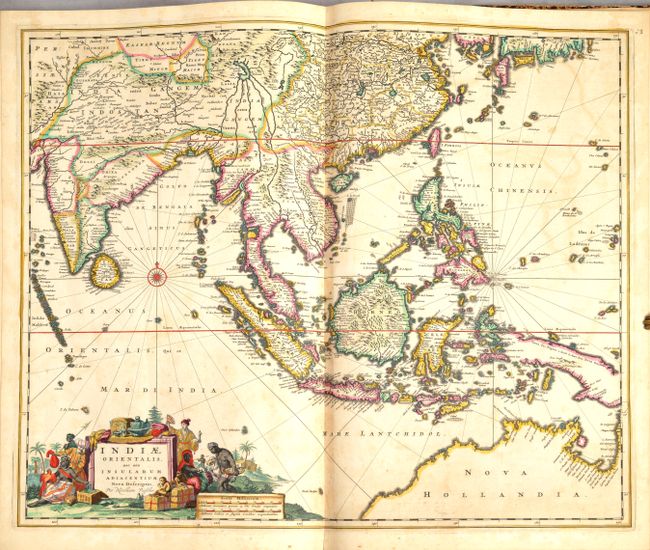
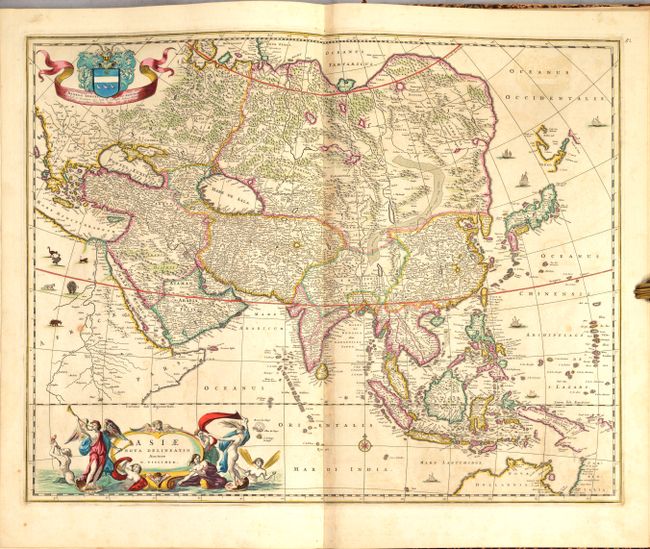
D. Indiae Orientalis, nec non Insularum Adiacentium Nova Descriptio. This superb map of Southeast Asia presents a detailed image of the sphere of operations and Asian trading empire of the Dutch East India Company. The map extends from India to the Philippines and the Ladrone Islands, and from southern Japan to the recent Dutch discoveries in Northern Australia. There is a partial outline of Papua New Guinea and considerable cartographic data in the East Indies. The fabulous title cartouche is surrounded by various people of the region and a bounty of trade goods. Reference: Tooley (Australia) #1300.
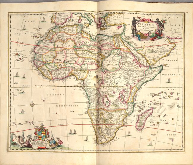
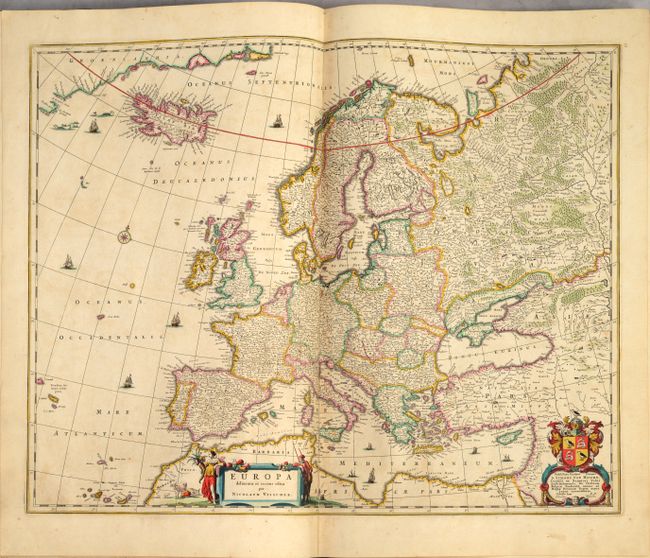
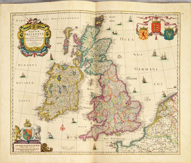
The other maps in the atlas are: Africae Accurata Tabula; Asiae Nova Delineatio; Turcicum Imperium; Europa Delineata et Recens Edita; Regni Daniae; Tabula Exactissima Regnorum Sueciae et Norvegiae; Nova Totius Livoniae; Tabula Russiae; Regni Poloniae et Ducatus Lithuaniae; Tabula Prussiae; Tabula Germaniae; Electoratus Brandenburgi; Pomeraniae Ducatus; Ducatus Bremae et Ferdae; Ducatus Brunsvicensis Fereque Lunaeburgensis; Ducatus Luneburgensis; Nova Totius Westphaliae; Ducatus Iuliacensis; Totius Fluminis Rheni; Utruisque Alsatiae Superioris; Helvetiae; Totius Regni Hungariae (2-sheet); Novissima et Accuratissima XVII Provinciarum Germaniae Inferior; Belgii Regii; Tabula Ducatus Brabantiae; Limburgi Ducatus et Comitatus; Dioecesis Leodiensis; Ducatus Lutzenburgi; Flandriae Comitatus; Geographica Artesiae Comitatus Tabula; Comitatus Hannoniae; Comitatus Namurci; Mechlinia Dominium et Aerschot; Marchionatus Sacri Romani Imperii; Belgium Foederatum; Ducatus Geldria et Zutphania; Novissima Comitatus Zutphaniae; Comitatus Hollandiae Tabula; Comitatus Zelandiae; Ultraiectini Dominii Tabula; Dominii Frisiae Tabula; Transisalania Provincia vulgo Over-Yssel; Dominii Groningae; Tabula Frisiae, Groningae; Drentia Comitatus; Magnae Britanniae Tabula; Gallia vulgo La France; Comitatus Burgundiae; Lotharingia Ducatus; Totius Regnorum Hispaniae et Portugalliae; Tabula Italiae; Regnum Siciliae; Comitatus Flandriae Nova Tabula; Flandria Gallica.
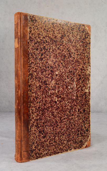
Elephant folio. Hardbound in quarter leather with tips over marbled-paper boards (likely 18th century) with modern end-papers.
References: cf. Philips #3431; cf. Shirley (BL Atlases) T.VIS-2a.
Condition: A
Sharp impressions on bright sheets with excellent, full contemporary color. There is occasional minor soiling on some of the maps, and a few of the maps have centerfold separations or minor tears that have been professionally repaired. The world map has two short tears within the southern polar hemisphere that have been archivally repaired on verso, and a sliver of the paper along the centerfold has lifted as well. The two extra maps at back are in "B" condition with soiling and dampstains. The title page has moderate soiling and some small edge chips and tears, most of which have been professionally repaired. The covers and spine are quite worn and scuffed, but still intact.