Catalog Archive
Auction 186, Lot 736

"South Africa",

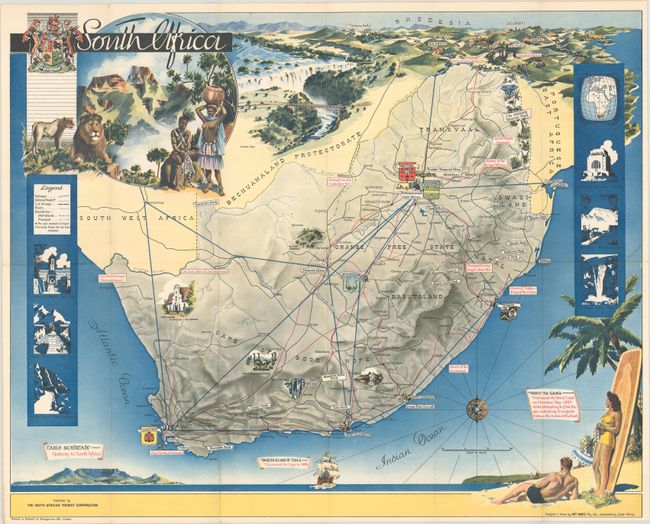
Subject: Southern Africa

Period: 1950 (circa)

Publication:

Color: Printed Color

Size:
22.1 x 17.8 inches
56.1 x 45.2 cm
Download High Resolution Image
(or just click on image to launch the Zoom viewer)

This tourist map shows the major roads, railways and air routes in South Africa and includes images of some of the sites to see, such as Kruger National Park, an ostrich farm, Dutch colonial architecture, and Cango caves. On verso is more information on what to do and see along with photographic images. The map was designed and drawn by Art Maps in Johannesburg. Published by the South African Tourist Corporation.

References:

Condition: A

Issued folding with a few tiny holes at fold intersections and light wear along the folds.

Estimate: $150 - $180

Sold for: $300

Closed on 2/9/2022

Archived