Catalog Archive
Auction 186, Lot 732

"Carte de la Barbarie, le la Nigritie et de la Guinee", Delisle/Elwe

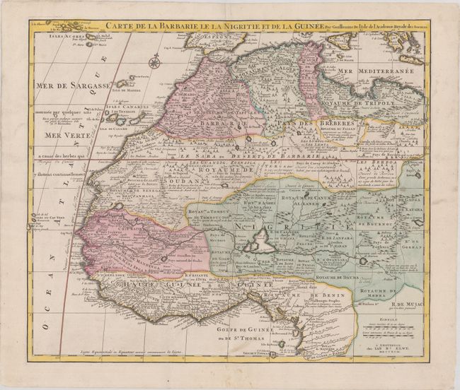
Subject: Western Africa

Period: 1792 (dated)

Publication: Atlas Geographique et Universel

Color: Hand Color

Size:
22.6 x 19.5 inches
57.4 x 49.5 cm
Download High Resolution Image
(or just click on image to launch the Zoom viewer)

This great 18th-century map of northwestern Africa spans from Barbary, Nigeria and Guinea to below the equator. There is a mass of geographic detail and notations in the interior with information on the rivers and lakes. Numerous tent encampments are depicted throughout the Sahara Desert. This map first appeared in Delisle's Atlas de Geographie (1700-1712) and was here re-issued by Jan Elwe, with his imprint at bottom right.

References: cf. Norwich #317.

Condition: B+

A sharp impression on a sheet with two elephant watermarks. There is light soiling and an archival repair to a centerfold separation in the bottom blank margin.

Estimate: $275 - $350

Sold for: $140

Closed on 2/9/2022

Archived