Subject: India & Sri Lanka
Period: 1752 (circa)
Publication: Histoire Generale des Voyages
Color: Black & White
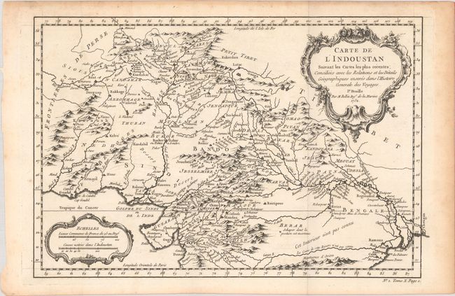
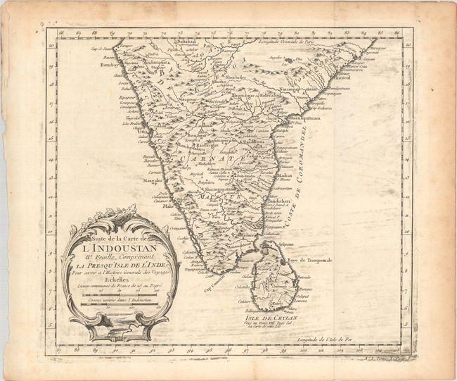
A pair of maps together depicting the Indian subcontinent, with nicely detailed topography. The first map depicts the northern part, which includes present-day Pakistan and Afghanistan. A river extending west from Baleshwar has a note indicating that the course of the river is unknown. The second map covers the southern part along with Sri Lanka. The maps stand on their own, with decorative title cartouches and their own borders.
A. Carte de l'Indoustan Suivant les Cartes les Plus Recentes, Conciliees avec les Relations et les Details Geographiques Inseres dans l'Histoire Generale des Voyages. Ie. Feuille, dated 1752 (13.5 x 8.9"). Condition: Issued folding on watermarked paper with light toning and minor foxing confined to the blank margins. (A)
B. Suite de la Carte de l'Indoustan IIe. Feuille, Comprenant la Presqu' Isle de l'Inde, pour Servir a l'Histoire Generale des Voyages, circa 1752 (9.8 x 8.7"). Condition: Issued folding on watermarked paper with light printer's ink residue in the image and some minor toning along the sheet edges. (B+)
References: Gole (India) #61-13 & 61-14.
Condition:
See description above.