Subject: Southern China
Period: 1655 (published)
Publication: Novus Atlas Sinensis
Color: Hand Color
Size:
19.1 x 15.5 inches
48.5 x 39.4 cm
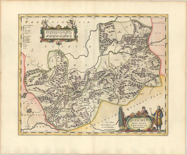
This map of the mountainous Guizhou Province depicts key cities, including Guiyang, Zunyi and Tongren. A long road through the region is shown dotted with forts. The map is decorated with two fine cartouches featuring putti and Chinese men showing the native costume of the region. Blank verso.
The second landmark in the European mapping of China was the appearance of the Novus Atlas Sinensis in 1655. It was compiled by Father Martino Martini, an Italian Jesuit, and produced by the most prominent Dutch cartographer of the time, Johannes Blaeu. Father Martini compiled the work based on Chinese sources between 1643 and 1650, and it greatly advanced European knowledge of the region including the astronomical positions of many cities and topographical features. It remained the standard geographical work on that country until the publication in 1737 of D'Anville's Atlas de la Chine.
References: Van der Krogt (Vol. II) #8434:2.
Condition: A
A dark impression on a bright, sturdy sheet with very light offsetting and a hint of soiling.