Subject: Middle East
Period: 1850 (circa)
Publication: Illustrated Atlas and Modern History of the World
Color: Hand Color
The maps from The Illustrated Atlas were first published in serial form to a target audience that led insular lives due to the expense and hardship of travel. All that changed as the progress of the nineteenth century brought swift and dramatic changes in public awareness of far away places. Tallis' maps no doubt played an important role in this dramatic awakening. These maps not only provided up-to-date geographical knowledge, but also used vignette views within the map's design to show the native people and their occupations, cities and points of interest. The maps hark back to a cartographic tradition from the Dutch mapmakers of the seventeenth century with finely engraved decorative borders. The maps were drawn and engraved by John Rapkin with views drawn and engraved by a number of prominent artists. The maps were issued as a complete volume from 1851 until about 1865. Some of the maps were also published in other history books published by Tallis including British Colonies and, without the vignettes, in geographical dictionaries and encyclopedias until about 1880.
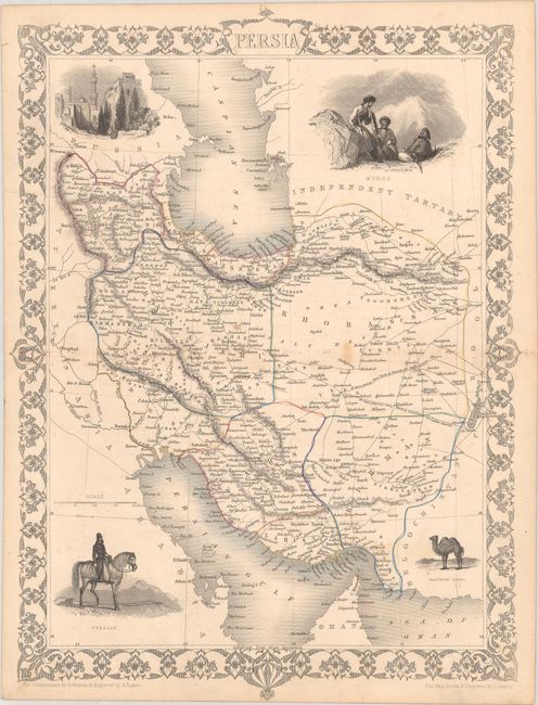
A. Persia, (10.1 x 13.7"). This finely engraved map of Persia extends from the Persian Gulf to the Caspian Sea. In the corners there are beautifully engraved and rendered vignettes of a Bactrian camel, a Persian, Kurds, and the city of Isfahan. The map is surrounded by a delicately engraved decorative border. The illustrations were drawn by H. Warren and engraved by S. Fisher; the map was drawn and engraved by John Rapkin. Condition: Contemporary outline color with a few light spots.
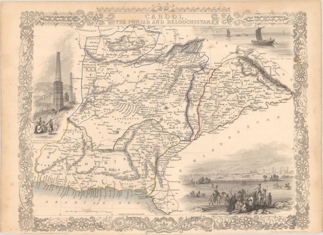
B. Cabool, the Punjab and Beloochistan, (13.3 x 10.5"). This elegant map centers on Afghanistan and Pakistan, with parts of Iran. Vignettes include "Boats on the Indus," "Sultan Mahmoud's Minars and Fortress, Ghuznee," and a large view of "Lahore" with many warriors and camels in the foreground. The illustrations were drawn by A. Fussell and engraved by J.B. Allen; the map is drawn and engraved by John Rapkin. Condition: Contemporary outline color with light dampstaining that enters the map image at top, minor foxing, and an edge tear in the left blank margin.
References:
Condition: B+
See description above.