Subject: Eastern Mediterranean & Middle East
Period: 1650 (dated)
Publication:
Color: Hand Color
Size:
18.8 x 12 inches
47.8 x 30.5 cm
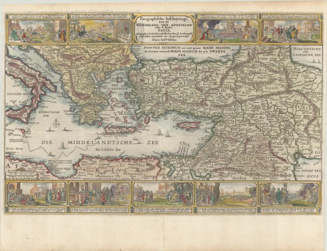
This map portrays the Eastern Mediterranean from Rome, through Asia Minor and the Holy Land, to Babylon. Territorial divisions reflect the political conditions of the first century A.D. The route of Apostle Paul is charted from Jerusalem to Rome. The decorative panels at top and bottom show the major events of Paul's journey; each vignette being a composite of two or three episodes. The one at the left of the cartouche shows Paul blinded on the road to Damascus, his baptism by Ananias, and finally his daring escape from the city. Other scenes depict the young Paul before his conversion, healing the paralytic, his ship wreck at Malta, and his appearance before Nero. Dutch text on verso.
References: cf. Laor #787; Poortman & Augusteijn #89.
Condition: A
A nice impression on a bright sheet, issued folding with professional repairs to a couple of short fold separations and tear in the top blank margin. Narrow side margins, as issued.