Subject: Sicily, Italy
Period: 1943 (dated)
Publication:
Color: Printed Color
Size:
45.9 x 33.3 inches
116.6 x 84.6 cm
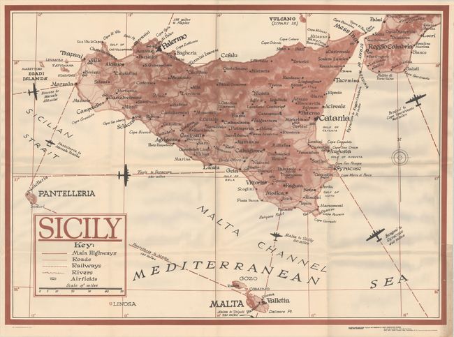
This large map of Sicily is part of the Newsmap series created by the U. S. Army during World War II. This map shows the island of Sicily with good detail of topography, towns, roads, railways and airfields. The flight paths from various cities are shown along with the distance between the cities. This map was likely distributed in preparation for the Allied invasion of Sicily in July and August 1943, in which the Allies successfully took the island from the Axis powers. This Newsmap is single-sided and blank on verso.
References:
Condition: B+
Issued folding and generally clean and bright, except for soiling and foxing at bottom right, mostly confined to the margin. There are also several short edge tears and extraneous creases at bottom right.