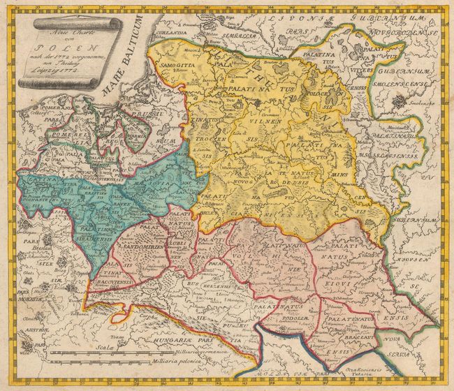
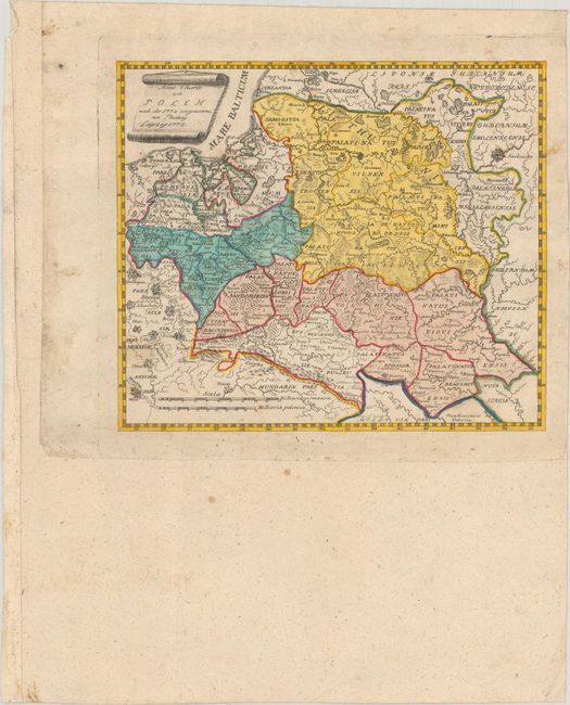
Subject: Eastern Europe
Period: 1772 (dated)
Publication:
Color: Hand Color
Size:
8.1 x 6.9 inches
20.6 x 17.5 cm
This rare map of the Polish-Lithuanian Commonwealth was published just after the First Partition of Poland. After the reign of Augustus III (1696-1763) weakened the Commonwealth, the Russian Empire, the Kingdom of Prussia and Habsburg Austria decided upon partitions of the Commonwealth, and simultaneously sent troops to occupy the newly annexed territories. The Commonwealth was unable to protect the occupied provinces, and ultimately lost 30% of its overall territory in the partition. The map identifies the regions that were seized by the neighboring powers by outlining them in color but not filling them in, with the remaining parts of Poland fully colored. There is incredible detail considering the size of the map, with information on towns, rivers, lakes, forests and political divisions.
References:
Condition: B+
Full contemporary color with light soiling. The map has been pasted onto another sheet of old paper with a fleur-de-lis watermark for inclusion in a larger book or composite atlas.