Subject: Central Europe
Period: 1788 (dated)
Publication:
Color: Hand Color
Size:
23.1 x 18 inches
58.7 x 45.7 cm
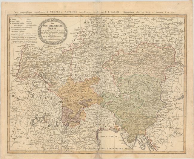
This detailed map focuses on the Austrian Circle of the Holy Roman Empire. The map extends from Prague south to the Adriatic Sea and from Bern to Blatten See (Lake Balaton) in Hungary. It features place names, political divisions, and topographical detail. A key at top left locates cities, villages, monasteries, castles, and more. There is a decorative title cartouche and three distance scales. An alternate French title runs across the upper neatline: Carte Geographique Representant le Cercle d'Autriche...
References:
Condition: B
On watermarked paper with extraneous creasing around the centerfold, two light dampstains that enter the map image at bottom, and light soiling. There are a couple short splits at bottom that have been partially closed with tape on recto and verso.