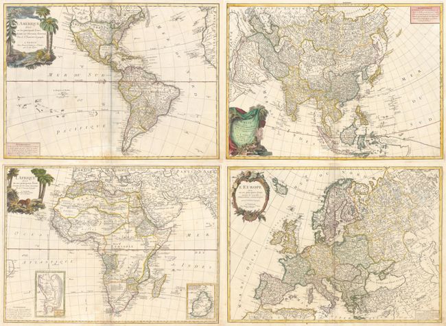
Subject: Continents
Period: 1776 (circa)
Publication: Atlas Universel
Color: Hand Color
Size:
25.2 x 18.3 inches
64 x 46.5 cm
This matching set of continents are Italian editions of Janvier's maps, published by Santini. Included are:
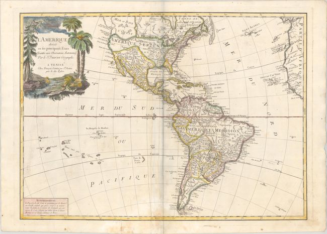
A. L'Amerique Divisee en ses Principaux Etats... The most striking feature of this map is the huge Sea of the West, which extends out of the top border, and is connected by a series of rivers to Hudson Bay in the north and nearly connects to the Mississippi River in the south. The large decorative title cartouche shows a stream filled with unusual beaver dams and a pine tree on one bank and palm trees and a native's headdress and quiver on the other. Reference: McGuirk #162.
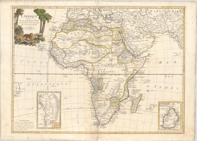
B. L Afrique Divisee en ses Principaux Etats... This handsome map of the continent shows the extent of European geographical knowledge in the mid-18th century. Much of the interior is still a mystery. While mostly accurate, the map does have remnants of fantasy such as the twin lake source of the Nile in the Les Montagnes de la Lune, which in this depiction is quite a bit north of the Equator. Southern Africa is occupied by the Hottentots tribes. Notes on the natives and the land are peppered throughout the map. Two insets focus on the Cape of Good Hope and Mauritius, respectively. The pictorial title cartouche features a majestic lion and some palm trees.
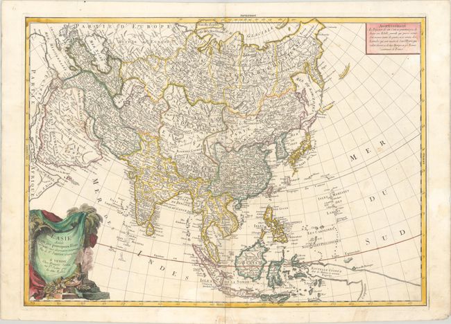
C. L'Asie Divisee en ses Principaux Etats... This handsome, large map covers all of Asia, including Indonesia, the Philippines and Japan. There is still some confusion in the region of Hokkaido and Sakhalin Island (Isle de Jedso). The Sea of Japan is labeled Mer de Coree. The coastline of Nouvelle Guinee is elongated, with dotted lines stretching off the map, hinting at a connection with Australia. The Carolines are also labeled Nouvelles Philippines. The large title cartouche incorporates an incense pot with a pile of treasure. Reference: Yeo #174.
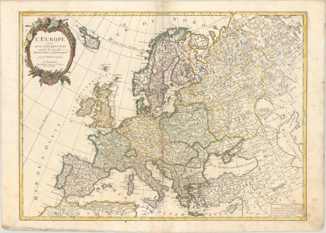
D. L'Europe Divisee en ses Principaux Etats... A densely engraved map of the continent with a decorative title cartouche featuring instruments for a surveyor and geographer. The map includes Iceland and extends to the Caspian Sea. Germany is shown encompassing all of central Europe, while the Turkish Empire extends through the Balkans and southern Ukraine.
References:
Condition: B+
Crisp impressions on bright, sturdy sheets with the watermarks of three crescent moons and the initials "A S." The maps have contemporary outline color with later color in the cartouches, light soiling, faint dampstains at bottom center, and professional repairs to centerfold separations and small chips and tears in the bottom blank margin. The first image is a composite image - the maps are on four separate sheets.