Subject: Central Europe, Germany
Period: 1638 (circa)
Publication: Newer Atlas
Color: Hand Color
Size:
18.8 x 15 inches
47.8 x 38.1 cm
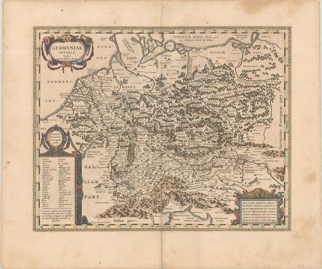
Jansson based this handsome map on Ortelius' map of ancient Germany. The region covered takes in all of central Europe from Belgium and France through Poland, to include northern Italy and Hungary. The map is based on the writing of classical authors such as Ptolemy, Caesar, and Strabo. It was richly engraved by Petrus Kaerius and features three large strapwork cartouches. German text on verso, published 1638-42.
References: Van der Krogt (Vol. I) #2000H:1A.
Condition: B+
A sharp impression with a couple light spots in map image and a 6.75" centerfold separation at bottom that has been closed with archival materials on verso.