Subject: Portugal & Western Spain
Period: 1675 (circa)
Publication:
Color: Hand Color
Size:
22.2 x 19.5 inches
56.4 x 49.5 cm
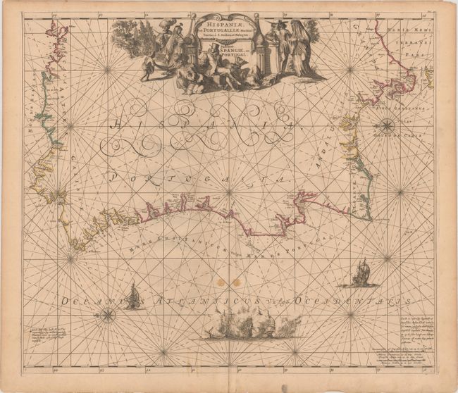
This sea chart shows the western portion of the Iberian peninsula with north oriented to the left. The chart extends northeast as far as Bilbao and southeast to Malaga. The Strait of Gibraltar is labeled, and the northern tip of Morocco is also included. Names are provided for the cities, ports, capes, and islands along the coastline. A scene of a naval battle along with two ships are shown in the Atlantic Ocean, as well as two compass roses with rhumb lines. The elaborate title cartouche at the top center of the map is decorated with regional figures, illustrating contemporary dress, in addition to a decapitated figure.
References:
Condition: B+
A nice impression with contemporary outline color, several stains along the centerfold near the bottom of the image, and professional repairs to minor separations along the centerfold.