Subject: Western England & Wales
Period: 1675 (circa)
Publication: Britannia
Color: Hand Color
Size:
16.5 x 13.1 inches
41.9 x 33.3 cm
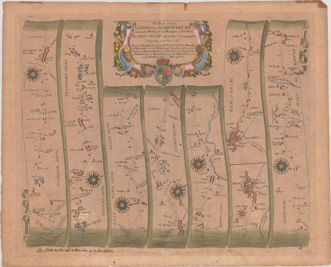
John Ogilby's 'Britannia' was published between 1675 and 1698. It is a landmark in the mapping of England and Wales. Its unique format constituted the first national road-atlas of any country in Western Europe. It was composed of maps of seventy-three major roads and cross-roads, presented in a continuous strip-form, on a uniform scale of one inch to a mile. Each beautiful map includes wonderful detail of the countryside with each strip containing a large compass rose to indicate changes in direction.
This strip-style map covers the road from Meriden, through Birmingham to Shrewsbury, and then continuing just over the border to Welshpool, Wales, in seven strips totaling 77 miles. The sixth strip is separated into two sections, with the first ending at Shrewsbury and the second beginning at Shrewsbury. Each of the panels has a decorative compass rose to orient the traveler. The lovely strapwork title cartouche includes fruit and the royal coat of arms.
References: Shirley (BL Atlases) T.OGIL-4a #50.
Condition: B
Toned and foxed with a faint dampstain in the bottom blank margin and some old tape stains along the top edge of the sheet. There is an old manuscript notation below the image at left.