Subject: England & Wales
Period: 1936 (circa)
Publication:
Color: Printed Color
Size:
11 x 14.9 inches
27.9 x 37.8 cm
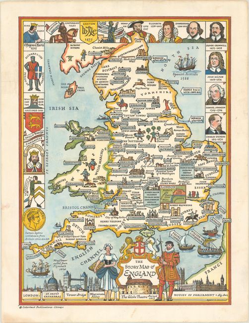
This charming pictorial map gives an overview of the history of England and Wales. Major cities are located, some of which include images of important buildings and structures, such as Stonehenge and Windsor Castle. Famous London buildings are shown at bottom, alongside the title cartouche, a maiden and a Yeoman Warder. The partial border incorporates portraits of important people in British history, including Afred the Great, Elizabeth I, Shakespeare, and Charles Dickens. Created by Egbert G. Jacobsen and published in Chicago by Colortext Publications, which created a series of Story Maps between 1935-50.
References: cf. Rumsey #10018.
Condition: A
A bright example with light soiling along the edges of the sheet, professionally backed in thin tissue to repair a couple of small edge tears.