Subject: Britain, World War II
Period: 1942 (circa)
Publication:
Color: Printed Color
Size:
28.4 x 38.6 inches
72.1 x 98 cm
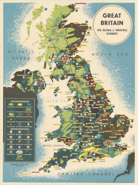
This wall map of Great Britain focuses on agricultural and industrial resources, noted throughout the map and identified in an extensive key at left, obscuring the Republic of Ireland. Major cities are named and the main road system is also shown. The map is a fascinating example of World War II-era persuasive cartography, depicting Britain as self-sufficient and rich with resources. However, at the time of the map's publication, British shipping and trade was under siege from German U-boats, threatening the safe passage of critical imports of food and other resources, such as oil and iron. Despite the constant threat of U-boat attacks, Britain received 90% of its supply shipments, and in May 1943, the Germans ended their U-boat offensive. The map was distributed by the British Information Services from their office in New York City. The British Information Services spearheaded the British propaganda effort and helped to pull the United States into the war.
References:
Condition: A
A clean and bright example, issued folding and now flattened and professionally backed in thin, archival tissue.